Canada topo
Autor:
User:Anchjo (from en:Wikipedia User:Captain_Blood)
Attribution:
Obraz jest oznaczony jako „Wymagane uznanie autorstwa” (attribution required), ale nie podano żadnych informacji o uznaniu autorstwa. Prawdopodobnie parametr atrybucji został pominięty podczas korzystania z szablonu MediaWiki dla licencji CC-BY. Autorzy mogą znaleźć tutaj przykład prawidłowego korzystania z szablonów.
Credit:
From English Wikipedia image of 7-July-2005, same name: en:Image:Canada topo.jpg (which now points here to Commons).
Krótki link:
źródło:
Wymiary:
1400 x 1211 Pixel (810081 Bytes)
Opis:
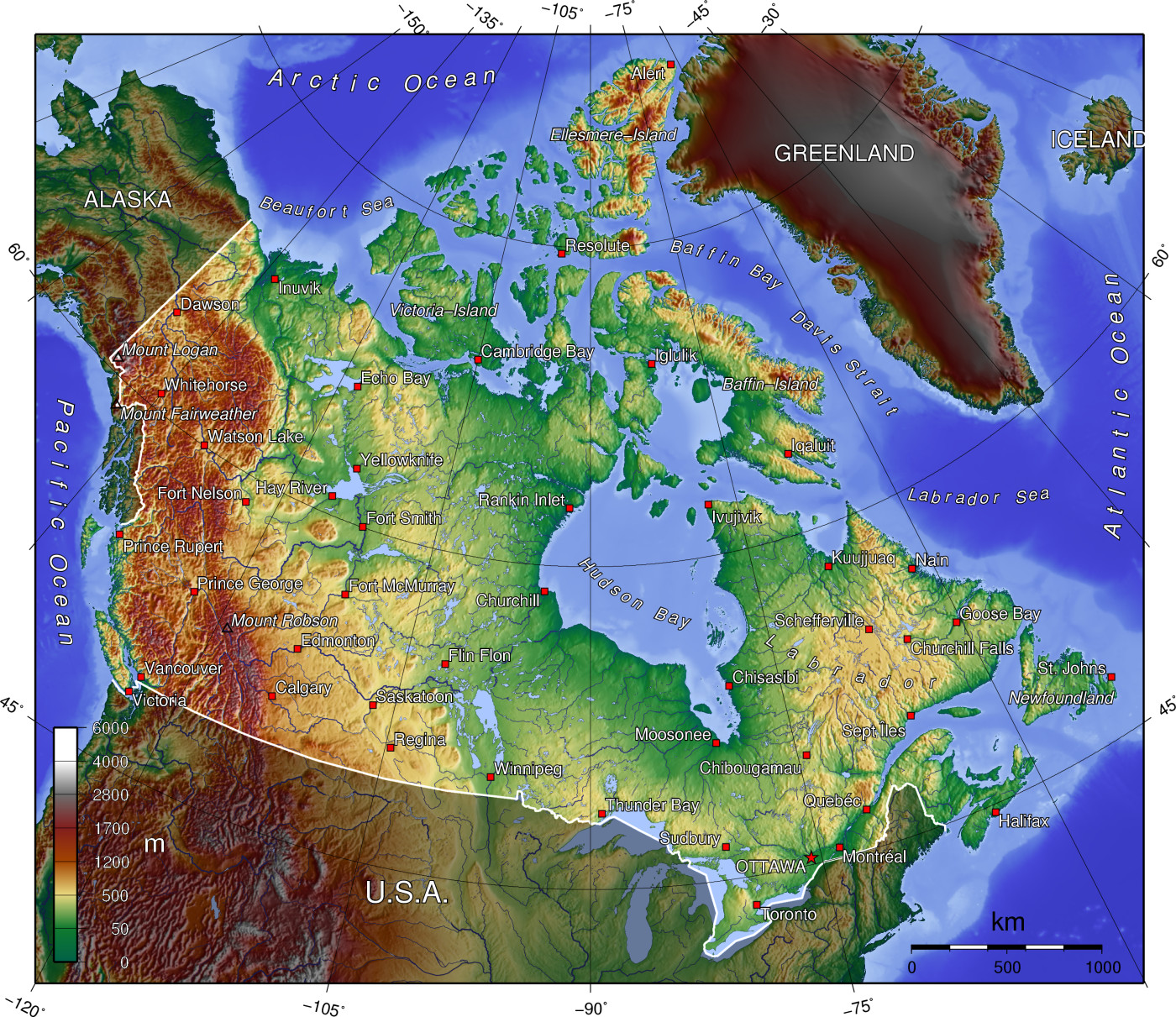
A topographic map of Canada, in polar projection (for 90° W), showing elevations shaded from green to brown (higher), with elevation-legend overlaid at lower left. Nearby countries are shaded darker (compare elevation shades at Canadian borders).
The image is centered over longitude 90° W, with longitude meridians at 15-degree intervals apart, and latitude parallels also 15-degree. The boundaries are roughly from longitude 10°W to 177°W, and latitude 40°N to 84°N (above northern-most Alert, Canada 82°28′N, 62°30′W).
Licencja:
Warunki licencji:
Creative Commons Attribution-Share Alike 3.0
Więcej informacji o licencji można znaleźć tutaj. Ostatnia aktualizacja: Sat, 17 Dec 2022 17:10:42 GMT