ChathamSunPier4167P
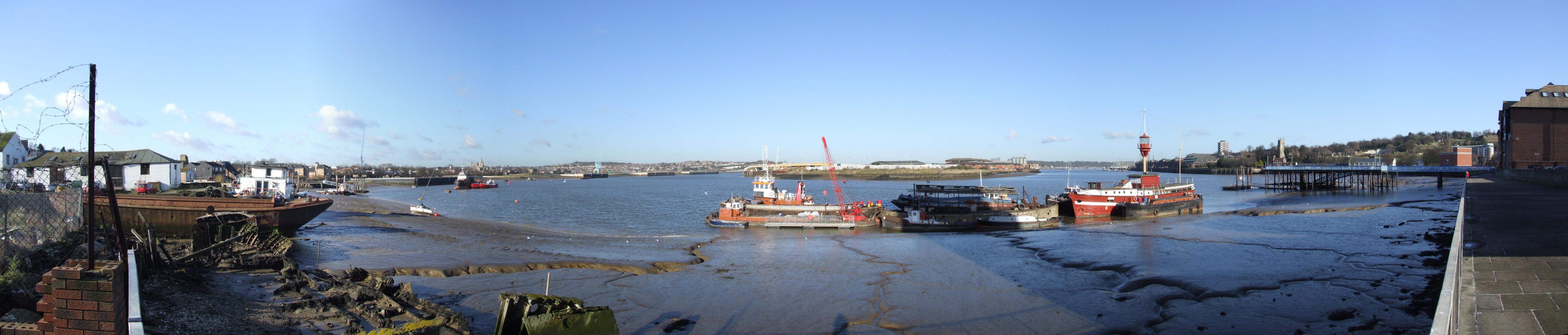
Medway Estuary at Chatham, by Sun Pier. A view of the River Medway Estuary, from Anchorage House Chatham. From Left to Right we see Limehouse Reach with Ship Pier, two trains in Rochester station, Rochester Cathedral and Castle . At Gashouse point the river veers port onto Bridge Reach. On the horizon is Strood and All Saints Frindsbury. In front is the Frindsbury Peninsula and its nearest point is Chatham Ness. Behind the lightship is Chatham Reach. On the left bank we can just see Upnor Castle, and on the horizon Chattenden. On the right bank, we see the buildings of Chatham Dockyard. Then we have Medway Council headquarters, with the flats at Melville Court behind, Chatham Parish Church, the Command House pub, sun pier with the library with Fort Amherst Caveyard behind, the Rats Bay pumping station with Upper Cornwallis battery behind.
| Pozycja fotografa |
|
To i inne zdjęcia na: OpenStreetMap |
|
|---|
Więcej informacji o licencji można znaleźć tutaj. Ostatnia aktualizacja: Mon, 21 Mar 2022 01:17:00 GMT