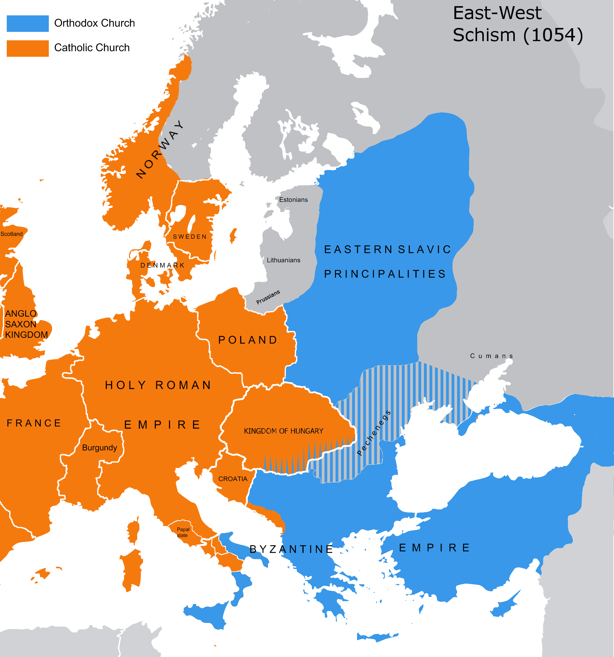
Great Schism 1054 with former borders
Autor:
own work
Credit:
1. http://home.comcast.net/~DiazStudents/MiddleAgesChurchMap1.jpg (source that showing official & dominant religions on the state level)
2. [1] - Dragan Brujić, Vodič kroz svet Vizantije, Beograd, 2005, page 51. (source that showing more detailed religious distribution in southeastern Europe and western Asia)
2. [1] - Dragan Brujić, Vodič kroz svet Vizantije, Beograd, 2005, page 51. (source that showing more detailed religious distribution in southeastern Europe and western Asia)
Krótki link:
źródło:
Wymiary:
2000 x 2141 Pixel (505861 Bytes)
Opis:
The map of the eastern/western allegiances in 1054 with the former country borders. Please, even if you trust only the modern national points of view about the past, don't erase the existence of the orthodox slavs and others in Eastern Hungary (proven by slavonic inscriptions Црковнъ писаный). Thank you.
Licencja:
Public domain
Więcej informacji o licencji można znaleźć tutaj. Ostatnia aktualizacja: Mon, 01 Nov 2021 01:06:09 GMT