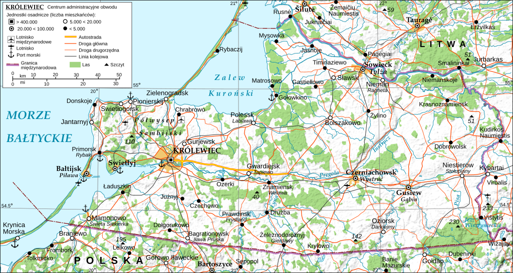
KALININGRAD PL
Autor:
- File:KALININGRAD FINAL.svg: Andrein
- derivative work: YazJazz
Attribution:
Obraz jest oznaczony jako „Wymagane uznanie autorstwa” (attribution required), ale nie podano żadnych informacji o uznaniu autorstwa. Prawdopodobnie parametr atrybucji został pominięty podczas korzystania z szablonu MediaWiki dla licencji CC-BY. Autorzy mogą znaleźć tutaj przykład prawidłowego korzystania z szablonów.
Credit:
Krótki link:
źródło:
Wymiary:
1424 x 759 Pixel (3313647 Bytes)
Opis:
General map of the Kaliningrad Oblast, Russian Federation, with Polish names: main and variant exonyms (given in italics) established by the Commission on Standardization of Geographical Names Outside the Republic of Poland. Made with 3DEM, GRASS GIS, The Gimp and Inkscape software from public-domain GIS data (SRTM3, VMAP0). The relief shading is embedded bitmap graphics. Projection: UTM. Geodetic datum: Wgs84. Additional references: 1. Wikipedia Kaliningrad Oblast related articles and lists; 2. the 'Great Road Atlas of Europe', Freytag&Berndt u. Artaria KG, Vienna 2007; 3. Soviet military topographic maps (scale 1:500.000) - http://maps.poehali.org/en/. Use the other version of this file for translations.
Licencja:
Warunki licencji:
Creative Commons Attribution-Share Alike 3.0
Więcej informacji o licencji można znaleźć tutaj. Ostatnia aktualizacja: Tue, 27 Dec 2022 12:21:16 GMT
