New-Map-Francophone World
Autor:
aaker
Credit:
Praca własna
Krótki link:
źródło:
Wymiary:
2664 x 1468 Pixel (123370 Bytes)
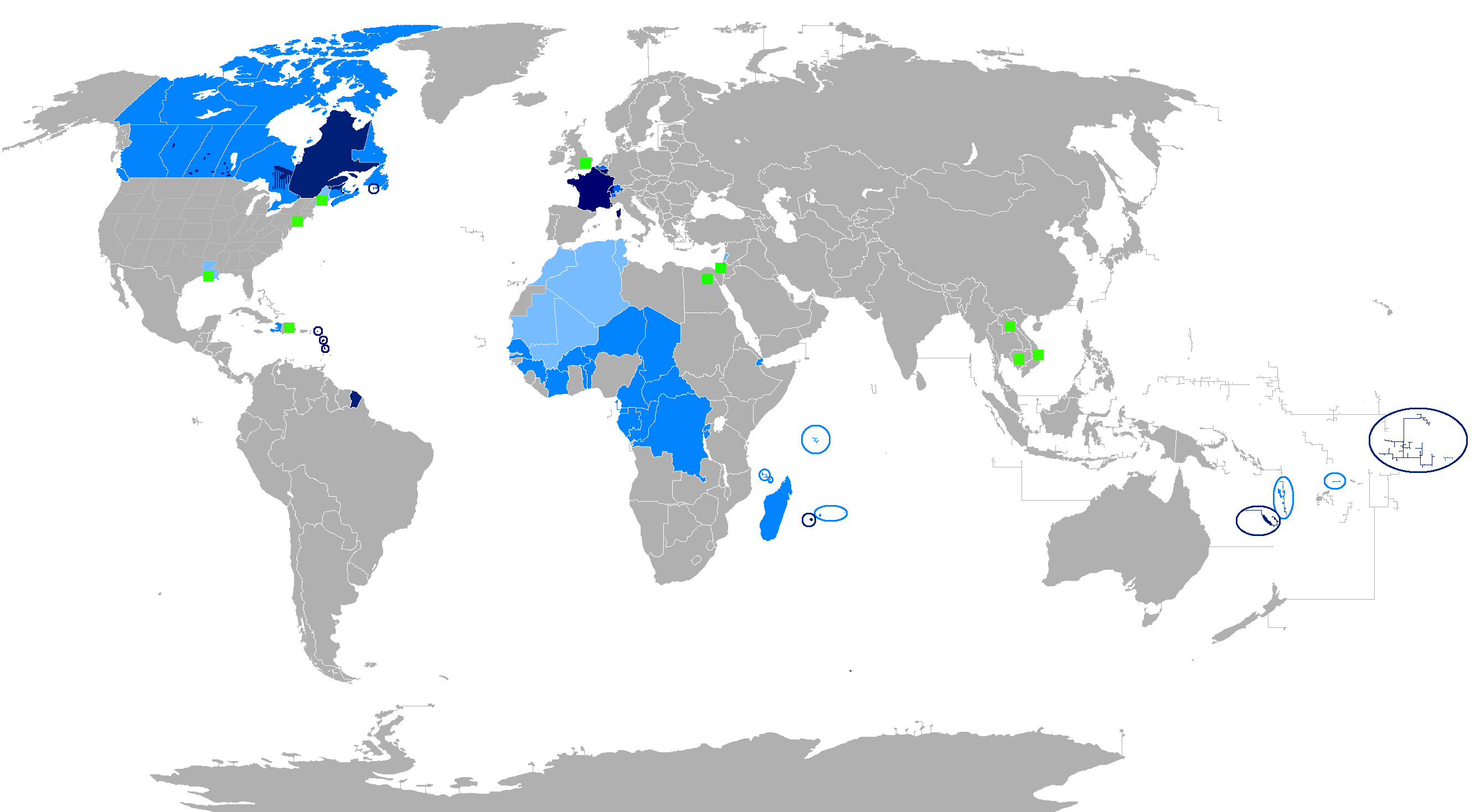
Opis:
The French language in the world
Regions where French is the main language
Regions where it is an official language
Regions where it is a second language
Regions where it is a minority language
The following things have been changed from the old "Map-Francophone World.PNG":
- Vietnam, Cambodia and Laos are no longer colored in light blue, this is because French is no longer regularly used.
- Lebanon, Tunisia, Mauritania, Morocco, and Algeria have been colored light blue, because the French language is widely used to a degree similar to a second language. There are even more French speakers in those countries than when French was the official language.
- The Western Sahara has been colored light blue, due to the increased use of French there.
- A green square has been added in London to recognize the French-speaking minority there.
To be modified :
- The status of French language in Africa depends on the country. For instance in Senegal French is not always used in the street and the status of official language fits well whereas in Gabon this is the only used language, except for the eldest between people of a same ethnie so in Gabon the French is the main language.
Licencja:
Public domain
Więcej informacji o licencji można znaleźć tutaj. Ostatnia aktualizacja: Mon, 22 Mar 2021 00:34:03 GMT