Southern ocean gravity hg
Autor:
Hannes Grobe, AWI
Credit:
Antarctic continent: own work; gravity field: NOAA/NGDC (Marks, McAdoo & Smith)
Krótki link:
źródło:
Wymiary:
1155 x 806 Pixel (1240489 Bytes)
Opis:
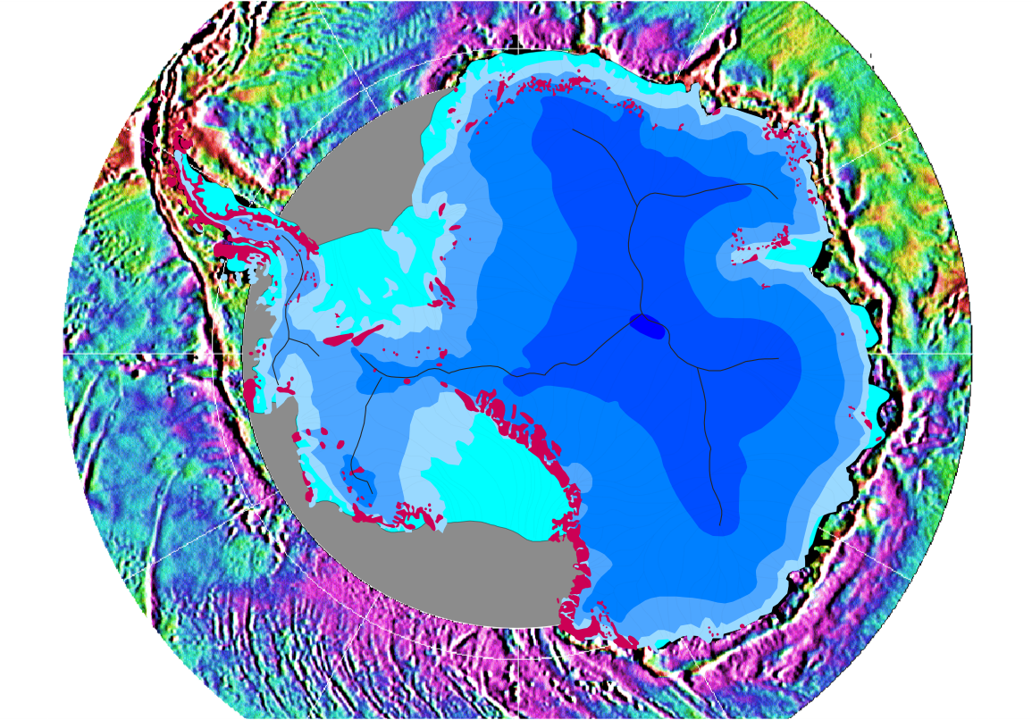
Gravity map of the Southern Ocean around the Antarctic continent
This gravity field was computed from sea-surface height measurements collected by the US Navy GEOSAT altimeter between March, 1985, and January, 1990. The high density GEOSAT Geodetic Mission data that lie south of 30 deg. S were declassified by the Navy in May of 1992 and contribute most of the fine-scale gravity information.
The Antarctic continent itself is shaded in blue depending on the thickness of the ice sheet (blue shades in steps of 1000 m); light blue is shelf ice; gray lines are the major ice devides; pink spots are parts of the continent which are not covered by ice; gray areas have no data.
Licencja:
Public domain
Komentarz do licencji:
Own work and public domain of NOAA
Więcej informacji o licencji można znaleźć tutaj. Ostatnia aktualizacja: Thu, 22 Dec 2022 18:26:14 GMT