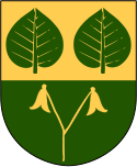
Älmhult
 IKEA w Älmhulcie | |
| Państwo | |
|---|---|
| Region | |
| Gmina | |
| Powierzchnia | 10,00[1] km² |
| Populacja (2018) • liczba ludności • gęstość | |
| Nr kierunkowy | (+46) 476 |
| Kod pocztowy | 343 xx |
| Strona internetowa | |
| Portal | |
Älmhult – miejscowość (tätort) w południowej Szwecji, w regionie administracyjnym (län) Kronoberg. Siedziba władz (centralort) gminy Älmhult.
Miejscowość jest położona w południowo-zachodniej części prowincji historycznej (landskap) Smalandia, około 60 km na południowy zachód od Växjö przy drodze krajowej nr 23 i linii kolejowej Södra stambanan.
W 1953 Ingvar Kamprad, pochodzący z najbliższych okolic miejscowości, otworzył w Älmhult sklep meblowy. W 1958 został tu otwarty pierwszy dom handlowy IKEA[2].
W 2010 Älmhult liczył 8955 mieszkańców[3].
Przypisy
- ↑ a b c Statistiska tätorter 2018; befolkning, landareal, befolkningstäthet. Statistikmyndigheten SCB, 2020-03-20. [dostęp 2020-09-08]. [zarchiwizowane z tego adresu (2020-03-24)]. (szw.).
- ↑ IKEA: IKEA Älmhult 50 år. [dostęp 2015-02-22]. [zarchiwizowane z tego adresu (2015-02-22)]. (szw.).
- ↑ Statistiska centralbyrån: Befolkning och arealer. [dostęp 2015-02-22]. (szw.).
Media użyte na tej stronie
Autor: Christian Koehn (fragwürdig), Licencja: CC-BY-SA-3.0
IKEA store in Älmhult, Sweden.
Autor: Marmelad
, Licencja: CC BY-SA 2.5
This coat of arms was drawn based on its blazon which – being a written description – is free from copyright. Any illustration conforming with the blazon of the arms is considered to be heraldically correct. Thus several different artistic interpretations of the same coat of arms can exist. The design officially used by the armiger is likely protected by copyright, in which case it cannot be used here.
Individual representations of a coat of arms, drawn from a blazon, may have a copyright belonging to the artist, but are not necessarily derivative works.
(c) Lokal_Profil, CC BY-SA 2.5
This coat of arms was drawn based on its blazon which – being a written description – is free from copyright. Any illustration conforming with the blazon of the arms is considered to be heraldically correct. Thus several different artistic interpretations of the same coat of arms can exist. The design officially used by the armiger is likely protected by copyright, in which case it cannot be used here.
Individual representations of a coat of arms, drawn from a blazon, may have a copyright belonging to the artist, but are not necessarily derivative works.
Autor: Erik Frohne, Licencja: CC BY 3.0
Location map of Kronoberg County in Sweden. N-S stretching is 183%, geographic limits of the map:
- N: 57.30° N
- S: 56.30° N
- W: 13.20° E
- E: 16.00° E


