Älta
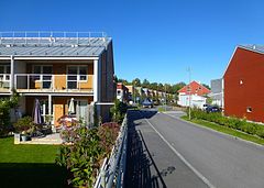
 Fragment zabudowy Älty | |
| Państwo | |
|---|---|
| Region | |
| Gmina | Nacka |
| Powierzchnia | 3,32 km² |
| Populacja (2010) • liczba ludności • gęstość | 9989 3011 os./km² |
| Nr kierunkowy | (+46) 08 |
| Kod pocztowy | 138 xx |
| Portal | |
Älta – część tätortu Sztokholm[a][1], w regionie administracyjnym (län) Sztokholm (gmina Nacka) w Szwecji.
Älta jest położona w prowincji historycznej (landskap) Södermanland; ok. 15 km na południowy wschód od centrum Sztokholmu w kierunku Tyresö. Należy w ramach gminy Nacka do części gminy (kommundel) Älta.
Najnowsza historia Älty sięga początku XX w., kiedy właściciel majątku ziemskiego Älta (Älta gård) rozpoczął sprzedaż działek przeznaczonych pod budowę domów letniskowych i jednorodzinnych[2]. Współcześnie w Älta dominuje zabudowa mieszana, z domami jedno- i wielorodzinnymi.
Z Älty pochodzi piosenkarka Petra Marklund.
W 2010 roku tätort Älta liczył 9989 mieszkańców[3].
Uwagi
- ↑ W 2015 roku po przeprowadzeniu przez Statistiska centralbyrån (SCB) nowego rozgraniczenia tätortów dotychczasowa miejscowość (tätort) Älta została zaliczona do obszaru tätortu Sztokholm.
Przypisy
- ↑ Statistiska centralbyrån: Förändringar i antalet tätorter, 2010–2015 (szw.). [dostęp 2016-11-28].
- ↑ Stockholms läns museum: Älta (szw.). [dostęp 2016-11-28].
- ↑ Statistiska centralbyrån: Befolkning och arealer (szw.). [dostęp 2016-11-28].
Media użyte na tej stronie
Autor: Holger.Ellgaard, Licencja: CC BY-SA 4.0
Bostadsområdet Södra Hedvigslund i Älta, Nacka kommun (Boxbomsvägen)
Autor: Erik Frohne, Licencja: CC BY 3.0
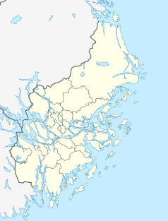
Location map of Stockholm County in Sweden
Equirectangular projection, N/S stretching 197 %. Geographic limits of the map:
- N: 60.30° N
- S: 58.70° N
- W: 17.10° E
- E: 19.50° E
(c) Lokal_Profil, CC BY-SA 2.5
This coat of arms was drawn based on its blazon which – being a written description – is free from copyright. Any illustration conforming with the blazon of the arms is considered to be heraldically correct. Thus several different artistic interpretations of the same coat of arms can exist. The design officially used by the armiger is likely protected by copyright, in which case it cannot be used here.
Individual representations of a coat of arms, drawn from a blazon, may have a copyright belonging to the artist, but are not necessarily derivative works.
Autor: Lokal_Profil
, Licencja: CC BY-SA 2.5
This coat of arms was drawn based on its blazon which – being a written description – is free from copyright. Any illustration conforming with the blazon of the arms is considered to be heraldically correct. Thus several different artistic interpretations of the same coat of arms can exist. The design officially used by the armiger is likely protected by copyright, in which case it cannot be used here.
Individual representations of a coat of arms, drawn from a blazon, may have a copyright belonging to the artist, but are not necessarily derivative works.


