Échassières
| gmina | |
 | |
| Państwo | |
|---|---|
| Region | |
| Departament | |
| Okręg | |
| Kod INSEE | 03108 |
| Powierzchnia | 23,27 km² |
| Populacja (2015 I) • liczba ludności |
|
| • gęstość | 17,3 os./km² |
| Kod pocztowy | 03330 |
| Portal | |
Échassières – miejscowość i gmina we Francji, w regionie Owernia-Rodan-Alpy, w departamencie Allier.
Demografia
Według danych na rok 1990 gminę zamieszkiwało 349 osób, a gęstość zaludnienia wynosiła 15 osób/km². W styczniu 2015 r. Échassières zamieszkiwały 402 osoby, przy gęstości zaludnienia wynoszącej 17,3 osób/km².
Bibliografia
Media użyte na tej stronie
Autor: Flappiefh, Licencja: CC BY-SA 4.0
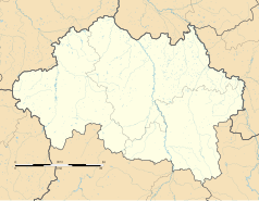
Blank administrative map of the department of Allier, France, for geo-location purpose.
Autor: Superbenjamin, Licencja: CC BY-SA 4.0
Blank administrative map of France for geo-location purpose, with regions and departements distinguished. Approximate scale : 1:3,000,000
Autor: Flappiefh, Licencja: CC BY-SA 4.0
Carte administrative vierge de la région Auvergne-Rhône-Alpes, France, destinée à la géolocalisation.
Autor: SMU Central University Libraries, Licencja: No restrictions
Title: Viaduc de la Bouble
Alternative Title: Bellon Viaduct
Creator: Unknown
Date: 1883
Part Of: Les Travaux Publics de la France, Tome Deuxieme: Chemins de Fer
Place: Louroux-de-Bouble, Allier, Auvergne, France
Physical Description: 1 photographic print: collotype; 26 x 35 cm on 40 x 56 cm mount
File: vault_folio_2_ta71_a4_1883_2_16_opt.jpg
Rights: Please cite Southern Methodist University, Central University Libraries, DeGolyer Library when using this image file. A high-quality version of this file may be obtained for a fee by contacting degolyer@smu.edu.
For more information, see: digitalcollections.smu.edu/cdm/ref/collection/eaa/id/844


