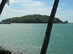
Île Saint-Joseph
 | |
| Kontynent | |
|---|---|
| Państwo | |
| Departament zamorski | |
| Akwen | |
| Archipelag | |
| Powierzchnia | 0,20 km² |
| Najwyższy punkt | 30 m n.p.m. |
| 5°16′53″N 52°34′54″W/5,281389 -52,581667 | |
Île Saint-Joseph – najbardziej wysunięta na południe wyspa w archipelagu Îles du Salut, należącym do Gujany Francuskiej. Jej powierzchnia wynosi 20 ha, a maksymalna wysokość to 30 m n.p.m.
Media użyte na tej stronie
Map of the Salvation Islands (Îles du Salut), off the coast of French Guiana.
Autor: Eric Gaba (Sting - fr:Sting), Licencja: CC BY-SA 3.0
Blank physical map of the region and department of the French Guiana, France, for geo-location purpose, with arrondissements boundaries.


