Červená Lhota (powiat Třebíč)
| |||||
| |||||
 | |||||
| Państwo | |||||
| Kraj | |||||
| Powiat | Třebíč | ||||
| Kraina | Morawy | ||||
| Powierzchnia | 7,40 km² | ||||
| Populacja (2014) • liczba ludności | 182[1] | ||||
| Kod pocztowy | 675 07 | ||||
| Szczegółowy podział administracyjny | |||||
| Liczba obrębów ewidencyjnych | 1 | ||||
| Liczba części gminy | 1 | ||||
| Liczba gmin katastralnych | 1 | ||||
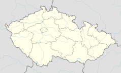
Położenie na mapie Czech (c) Karte: NordNordWest, Lizenz: Creative Commons by-sa-3.0 de | |||||
| Strona internetowa | |||||
| Portal | |||||
Červená Lhota – gmina w Czechach, w powiecie Třebíč, w kraju Wysoczyna. 1 stycznia 2014 liczyła 182 mieszkańców[1].
Przypisy
- ↑ a b Počty obyvatel v obcích k 1. 1. 2014 (cz.). www.mvcr.cz. [dostęp 2015-12-06].
Media użyte na tej stronie
Vysocina Region.png
Autor: Afil, Licencja: CC BY-SA 3.0
Location map of Vysocina Region in the Czech Republic
Autor: Afil, Licencja: CC BY-SA 3.0
Location map of Vysocina Region in the Czech Republic
Czech Republic adm location map.svg
(c) Karte: NordNordWest, Lizenz: Creative Commons by-sa-3.0 de
Location map of the Czech Republic
(c) Karte: NordNordWest, Lizenz: Creative Commons by-sa-3.0 de
Location map of the Czech Republic
Flag of Vysocina Region.svg
Flag of Vysočina Region
Flag of Vysočina Region
Červená Lhota TR CoA.jpg
Coat of Arms of Červená Lhota (Třebíč District), Czech Republic
Coat of Arms of Červená Lhota (Třebíč District), Czech Republic
Červená Lhota TR flag.svg
Municipal flag of cs:Červená Lhota village, Třebíč District, Czech Republic.
Municipal flag of cs:Červená Lhota village, Třebíč District, Czech Republic.
Center with church of Saint Lawrence in Červená Lhota, Stařeč, Třebíč District.jpg
Autor: Frettie, Licencja: CC BY 3.0
Center of village Červená Lhota with church of St. Lawrence.
Autor: Frettie, Licencja: CC BY 3.0
Center of village Červená Lhota with church of St. Lawrence.


