Świątynia Świtu
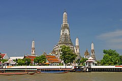
 Widok z rzeki | |
| Państwo | |
|---|---|
| Miejscowość | |
| Wyznanie | |
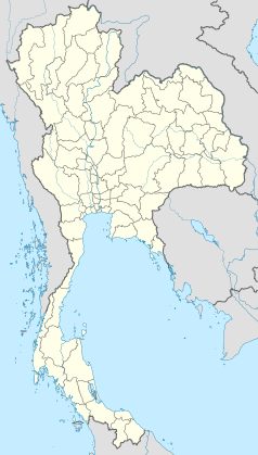
Położenie na mapie Bangkoku (c) Hdamm, CC BY-SA 3.0 | |
| Strona internetowa | |
Świątynia Świtu[1] (taj. วัดอรุณ, Wat Arun) – świątynia buddyjska w dzielnicy Bangkok Yai w Bangkoku (Tajlandia). Znajduje się na zachodnim brzegu rzeki Menam. Pełna nazwa świątyni to Wat Arunratchawararam Ratchaworamahavihara (วัดอรุณราชวรารามราชวรมหาวิหาร).
Przypisy
- ↑ Polski egzonim wprowadzony na 103. posiedzeniu KSNG.
Linki zewnętrzne
- Oficjalna strona świątyni. watarun.org. [zarchiwizowane z tego adresu (2014-12-16)].
Media użyte na tej stronie
The national flag of Kingdom of Thailand since September 2017; there are total of 3 colours:
- Red represents the blood spilt to protect Thailand’s independence and often more simply described as representing the nation.
- White represents the religion of Buddhism, the predominant religion of the nation
- Blue represents the monarchy of the nation, which is recognised as the centre of Thai hearts.
Autor: Diliff, Licencja: CC BY 2.5
Wat Arun taken from a public ferry on the Chao Phraya River on the 2nd of June, 2004.
(c) Hdamm, CC BY-SA 3.0
Location map of Bangkok; Geographic limits of the map:
- N: 13.9611° N
- S: 13.4658° N
- W: 100.3153° E
- E: 100.9417° E


