Żeleznodorożnyj (stacja kolejowa)
| ||
| Państwo | ||
| Miejscowość | Żeleznodorożnyj | |
| Poprzednie nazwy | Gerdauen | |
| Dane techniczne | ||
| Kasy | ||
| Linie kolejowe | ||
| ||
| Portal | ||
Żeleznodorożnyj – stacja kolejowa w Żeleznodorożnym, w obwodzie kaliningradzkim, w Rosji.
Bibliografia
- Žielieznodorožnyj w Ogólnopolskiej Bazie Kolejowej – bazakolejowa.pl
- Wikimapia
| Żeleznodorożnyj | ||
| Linia Żeleznodorożnyj – Węgorzewo | ||
odległość: 7,5 km | ||
| Linia 353 Poznań Wschód – Żeleznodorożnyj | ||
odległość: −1 km | ||
| Linia Winda – Żeleznodorożnyj | ||
odległość: −1 km | ||
| Linia Żeleznodorożnyj – Anielin Gradowo | ||
odległość: −1 km | ||
Media użyte na tej stronie
Autor: Uwe Dedering, Licencja: CC BY-SA 3.0
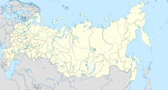
Location map of Russia.
EquiDistantConicProjection : Central parallel :
* N: 54.0° N
Central meridian :
* E: 100.0° E
Standard parallels:
* 1: 49.0° N
* 2: 59.0° N
Made with Natural Earth. Free vector and raster map data @ naturalearthdata.com.
Because the southern Kuril islands are claimed by Russia and Japan, they are shown as disputed. For more information about this see: en:Kuril Islands dispute. These islands are since 1945 under the jurisdiction of the Russian Federation.
Autor: MGalloway (WMF), Licencja: CC BY-SA 3.0
A tickmark icon included in the OOjs UI MediaWiki lib.
Autor: MGalloway (WMF), Licencja: CC BY-SA 3.0
A tickmark icon included in the OOjs UI MediaWiki lib.
head station, track to the left
head station, track to the left
Straight line aqross (according to naming convention, name + modifier)
head station, track to the right
head station, track to the right
Autor: NordNordWest, Licencja: CC BY-SA 3.0
Location map of the Kaliningrad Oblast, Russia


