202 km
| Państwo | |
|---|---|
| Miejscowość | |
| Dane techniczne | |
| Liczba peronów | 1 |
| Liczba krawędzi peronowych | 1 |
| Linie kolejowe | |
| Portal | |
202 km (ros. 202 км) – przystanek kolejowy pomiędzy miejscowościami Trostań i Wieliczka, w rejonie nowozybkowskim, w obwodzie briańskim, w Rosji. Położony jest na linii Briańsk - Homel.
Bibliografia
- о.п. 202 км. railwayz.info. [dostęp 2021-03-17]. (ros.).
- Google Maps
| 202 km | ||
| Linia Uniecza – Złynka (201,80 km) | ||
odległość: 6,10 km | odległość: 4,98 km | |
Media użyte na tej stronie
Autor: Nzeemin, Licencja: CC BY-SA 2.0
Административная карта Брянской области, Россия.
- Проекция: Меркатор
- Координаты для GMT: -R31.15/35.41/51.78/54.10
- Инструменты: GMT, Inkscape
Autor: Uwe Dedering, Licencja: CC BY-SA 3.0
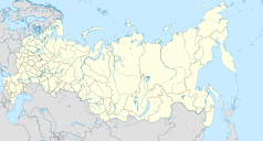
Location map of Russia.
EquiDistantConicProjection : Central parallel :
* N: 54.0° N
Central meridian :
* E: 100.0° E
Standard parallels:
* 1: 49.0° N
* 2: 59.0° N
Made with Natural Earth. Free vector and raster map data @ naturalearthdata.com.
Because the southern Kuril islands are claimed by Russia and Japan, they are shown as disputed. For more information about this see: en:Kuril Islands dispute. These islands are since 1945 under the jurisdiction of the Russian Federation.
head station, track to the left
head station, track to the left
Straight line aqross (according to naming convention, name + modifier)
station at track aqross
head station, track to the right
head station, track to the right


