Abbey Park
 Brama parku | |
| Państwo | |
|---|---|
| Miejscowość | Leicester |
| Dzielnica | Abbey |
| Powierzchnia | 13 ha |
| Data założenia | 1882 |
| Projektant | James Tait |
Położenie na mapie Leicesteru .svg "Mapa lokalizacyjna Leicesteru") Contains Ordnance Survey data © Crown copyright and database right, CC BY-SA 3.0 | |
Położenie na mapie Wielkiej Brytanii  (c) Karte: NordNordWest, Lizenz: Creative Commons by-sa-3.0 de | |
Położenie na mapie Anglii  | |
Położenie na mapie Leicestershire  Contains Ordnance Survey data © Crown copyright and database right, CC BY-SA 3.0 | |
| Strona internetowa | |
Abbey Park – park publiczny otwarty w 1882 r. położony w mieście Leicester w hrabstwie Leicestershire w Wielkiej Brytanii o powierzchni 13 hektarów. Przez park przepływa rzeka Soar, która go dzieli na dwie części. Dostęp do obu stron parku prowadzą dwa mosty w środkowej i południowej części parku.
W parku znajdują się ruiny Cavendish House z XVII wieku wybudowane przez Williama Cavendisha.
Atrakcją parku jest ogród chiński, mini kolejka, ogród zoologiczny, place zabaw, korty tenisowe, plac do gry w piłkę nożną oraz cricketa. W parku znajduje się również jeziorko gdzie można wypożyczyć rowery wodne, łódki[1].
Galeria

Abbey Park - most

Drzewa i krzewy w Abbey Parku
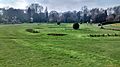
Abbey Park

Ruiny zamku w parku

Ruiny opactwa w parku

Budynek w Abbey Parku
Linki zewnętrzne
Przypisy
- ↑ Search our website, www.leicester.gov.uk [dostęp 2017-11-16] (ang.).
Media użyte na tej stronie
(c) Karte: NordNordWest, Lizenz: Creative Commons by-sa-3.0 de
Location map of the United Kingdom


Shiny green button/marker widget.

Autor: Kris1973, Licencja: CC BY-SA 4.0
Drzewa i krzewy w Abbey Parku


Bridge over River Soar, Abbey Park taken by kev747
Contains Ordnance Survey data © Crown copyright and database right, CC BY-SA 3.0
Map of Leicester, Leicestershire, UK with electoral wards shown.
Equirectangular map projection on WGS 84 datum, with N/S stretched 160%
Geographic limits:
- West: 1.22W
- East: 1.04W
- North: 52.70N
- South: 52.57N

Autor: NotFromUtrecht, Licencja: CC BY-SA 3.0
Ruins of Leicester Abbey, Abbey Park, Leicester. The nave of the abbey church is seen on the left, and the cloister is on the right.
Contains Ordnance Survey data © Crown copyright and database right, CC BY-SA 3.0
Map of Leicestershire, UK with the following information shown:
- Administrative borders
- Coastline, lakes and rivers
- Roads and railways
- Urban areas
Equirectangular map projection on WGS 84 datum, with N/S stretched 160%
Geographic limits:
- West: 1.80W
- East: 0.50W
- North: 53.00N
- South: 52.36N


Autor: NotFromUtrecht, Licencja: CC BY-SA 3.0
Entrance gate to Abbey Park, Leicester.