Abercarn
| ||
(c) Roger Cornfoot, CC BY-SA 2.0 Centrum Abercarn | ||
| Państwo | ||
| Księstwo | ||
| Hrabstwo | Caerphilly | |
| Populacja (2011) • liczba ludności | 5352[1] | |
Położenie na mapie Caerphilly Contains Ordnance Survey data © Crown copyright and database right, CC BY-SA 3.0 | ||
| Portal | ||
Abercarn – miasto w południowej Walii, w hrabstwie Caerphilly (historycznie w Monmouthshire[2]), położone w dolinie rzeki Ebbw[3]. W 2011 roku liczyło 5352 mieszkańców[1].
W XIX wieku funkcjonowały tu liczne kopalnie węgla, a także huty żelaza i cyny oraz zakłady chemiczne. W mieście znajdowała się stacja kolejowa, obecnie zamknięta[2].
11 września 1878 roku miała tu miejsce jedna z największych katastrof górniczych w historii Walii. W następstwie eksplozji zginęło wówczas co najmniej 268 górników, w tym 55 dzieci[4].
Przypisy
- ↑ a b Abercarn Built-up area Local Area Report (ang.). Nomis. [dostęp 2018-08-20].
- ↑ a b Abercarn, Monmouthshire (ang.). A vision of Britain through time. [dostęp 2018-08-30].
- ↑ Mapa OS Explorer 152, Ordnance Survey (ang.).
- ↑ Painting marks Abercarn Colliery disaster anniversary (ang.). BBC News, 2014-09-11. [dostęp 2018-08-30].
Media użyte na tej stronie
Autor: NordNordWest, Licencja: CC BY-SA 3.0
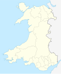
Location map of Wales, United Kingdom
Autor: NordNordWest, Licencja: CC BY-SA 3.0
Location map of the United Kingdom
Contains Ordnance Survey data © Crown copyright and database right, CC BY-SA 3.0
Blank map of Caerphilly, UK with the following information shown:
- Administrative borders
- Coastline, lakes and rivers
- Roads and railways
- Urban areas
Equirectangular map projection on WGS 84 datum, with N/S stretched 160%
Geographic limits:
- West: 3.40W
- East: 3.05W
- North: 51.83N
- South: 51.52N


