Aberfeldy
| ||
(c) David Greenhalgh, CC BY-SA 2.0 Budynek starego młyna wodnego przerobiony obecnie na księgarnię | ||
| Państwo | ||
| Kraj | ||
| Hrabstwo | Perth and Kinross | |
| Kod pocztowy | PH15 | |
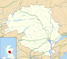
Położenie na mapie Perth and Kinross Contains Ordnance Survey data © Crown copyright and database right, CC BY-SA 3.0 | ||
Położenie na mapie Wielkiej Brytanii (c) Karte: NordNordWest, Lizenz: Creative Commons by-sa-3.0 de | ||
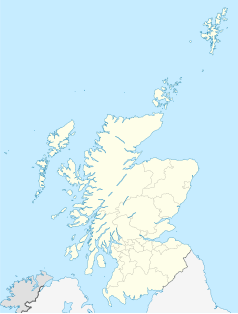
Położenie na mapie Szkocji | ||
| Strona internetowa | ||
| Portal | ||
Aberfeldy (gael.: Obar Pheallaidh) – miasto (pierwotnie burgh, czyli autonomiczna jednostka występująca tylko w Szkocji, niekoniecznie miasto) w hrabstwie Perth and Kinross w Szkocji, nad rzeką Tay. W 1725 roku założony został tutaj Black Watch, szkocki batalion piechoty[1].
W mieście znajduje się wytwórnia whisky Aberfeldy.
Przypisy
- ↑ Merriam-Webster's Geographical Dictionary. Praca zbiorowa. Wyd. 3. Londyn: Merriam-Webster, 2007, s. 2. ISBN 0-87779-546-0.
Linki zewnętrzne
Media użyte na tej stronie
(c) Karte: NordNordWest, Lizenz: Creative Commons by-sa-3.0 de
Location map of the United Kingdom
(c) Eric Gaba, NordNordWest, CC BY-SA 3.0
Location map of Scotland, United Kingdom
Contains Ordnance Survey data © Crown copyright and database right, CC BY-SA 3.0
Blank map of Perth and Kinross, UK with the following information shown:
- Administrative borders
- Coastline, lakes and rivers
- Roads and railways
- Urban areas
Equirectangular map projection on WGS 84 datum, with N/S stretched 180%
Geographic limits:
- West: 4.80W
- East: 2.95W
- North: 57.00N
- South: 56.10N
(c) David Greenhalgh, CC BY-SA 2.0
Old watermill building, Aberfeldy. The former watermill is now a shop, cafe and gallery. Some of the old machinery is visible inside, and the wheel itself is still in place.


