Abilene (Kansas)
| ||||
 Dom rodzinny prezydenta USA Eisenhowera | ||||
| Państwo | ||||
|---|---|---|---|---|
| Stan | ||||
| Hrabstwo | ||||
| Data założenia | 1857 | |||
| Prawa miejskie | 1869 | |||
| Kod statystyczny | ||||
| Powierzchnia | 10,7 km² | |||
| Wysokość | 352 m n.p.m. | |||
| Populacja (2010) • liczba ludności • gęstość |
| |||
| Nr kierunkowy | 785 | |||
| Kod pocztowy | 67410 | |||
| Strefa czasowa | ||||
| Strona internetowa | ||||
| Portal | ||||
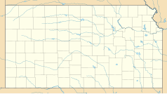
Abilene – miasto w Stanach Zjednoczonych, w stanie Kansas, w hrabstwie Dickinson, nad rzeką Smoky Hill. Liczba ludności: 6844 (2010 r.)[1].
Miasto posiada rozwinięty przemysł maszynowy, a także stanowi centrum handlowe okolicznego rolnictwa i hodowli bydła.
Początek historii miasta datuje się na rok 1857 – ekspansja ludności na zachód wiązała się z budową kolei, przez co Abilene stało się miejscem corocznego spędu bydła z pobliskiego Teksasu.
W mieście znajduje się dom rodzinny prezydenta Stanów Zjednoczonych Dwighta Eisenhowera. Chociaż się tu nie urodził, spędził w tym mieście swoje dzieciństwo i jest tu pochowany.
Przez 8 miesięcy w 1871 roku szeryfem był tu Dziki Bill Hickok.
Linki zewnętrzne
- Oficjalna strona internetowa miasta Abilene w Kansas (ang.)
- Kansas Statistical Abstract. ku.edu. [zarchiwizowane z tego adresu (2006-05-29)]. (ang.)
- Abilene Kansas Business Directory. comevisitabileneks.com. [zarchiwizowane z tego adresu (2013-05-27)]. (ang.)
Zobacz też
Przypisy
- ↑ a b American FactFinder. [dostęp 2012-08-27]. [zarchiwizowane z tego adresu (2020-02-12)].
Media użyte na tej stronie
Autor: Alexrk2, Licencja: CC BY 3.0
Ta mapa została stworzona za pomocą GeoTools.
Autor: Uwe Dedering, Licencja: CC BY-SA 3.0
Location map of the USA (without Hawaii and Alaska).
EquiDistantConicProjection:
Central parallel:
* N: 37.0° N
Central meridian:
* E: 96.0° W
Standard parallels:
* 1: 32.0° N
* 2: 42.0° N
Made with Natural Earth. Free vector and raster map data @ naturalearthdata.com.
Formulas for x and y:
x = 50.0 + 124.03149777329222 * ((1.9694462586094064-({{{2}}}* pi / 180))
      * sin(0.6010514667026994 * ({{{3}}} + 96) * pi / 180))
y = 50.0 + 1.6155950752393982 * 124.03149777329222 * 0.02613325650382181
      - 1.6155950752393982  * 124.03149777329222 *
     (1.3236744353715044  - (1.9694462586094064-({{{2}}}* pi / 180))
      * cos(0.6010514667026994 * ({{{3}}} + 96) * pi / 180))
The flag of Navassa Island is simply the United States flag. It does not have a "local" flag or "unofficial" flag; it is an uninhabited island. The version with a profile view was based on Flags of the World and as a fictional design has no status warranting a place on any Wiki. It was made up by a random person with no connection to the island, it has never flown on the island, and it has never received any sort of recognition or validation by any authority. The person quoted on that page has no authority to bestow a flag, "unofficial" or otherwise, on the island.
Autor: Scott Catron, Licencja: CC-BY-SA-3.0
Eisenhower Center grounds, Abilene, Kansas, USA


