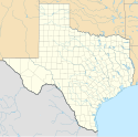
Abilene (Teksas)
| ||||
 | ||||
| Państwo | ||||
|---|---|---|---|---|
| Stan | ||||
| Hrabstwo | Taylor, Jones | |||
| Data założenia | 1881[1] | |||
| Prawa miejskie | 1882[1] | |||
| Kod statystyczny | FIPS: 48-01000 GNIS ID: 1329173 | |||
| Zarządzający | Norm Archibald | |||
| Powierzchnia | 286,5 km² | |||
| Wysokość | 524 m n.p.m. | |||
| Populacja (2019) • liczba ludności • gęstość | 123 420[2] 430,79 os./km² | |||
| Nr kierunkowy | 325 | |||
| Kod pocztowy | 79600-79699 | |||
| Strefa czasowa | UTC-6:00 UTC-5:00 | |||
| Strona internetowa | ||||
| Portal | ||||
Abilene – miasto w Stanach Zjednoczonych w środkowej części stanu Teksas, założone w 1881 roku przy drodze wiodącej nad Pacyfik.
Siedziba hrabstwa Taylor, ośrodek handlu i nauki (2 uniwersytety), centrum regionu wydobycia ropy naftowej i gazu ziemnego, przemysłu spożywczego, elektronicznego, lotniczego, maszynowego, materiałów budowlanych[1]. 5 km od miasta znajduje się Port lotniczy Abilene[3].
Demografia
Kościoły i związki wyznaniowe
Spis na 2010 rok, obejmuje aglomeracje miasta[4]:
- Południowa Konwencja Baptystów: 51 765 członków w 99 zborach
 0,7%
0,7% - Kościoły Chrystusowe: 14 448 członków w 58 zborach
 0,6%
0,6% - Zjednoczony Kościół Metodystyczny: 10 049 członków w 30 zborach
 1,8%
1,8% - Kościół katolicki: 8747 członków w 9 kościołach
 1,5%
1,5% - Protestantyzm bezdenominacyjny: 7740 członków w 30 zborach

- Zbory Boże: 2111 członków w 12 zborach
 8,0%
8,0% - Kościół Jezusa Chrystusa Świętych w Dniach Ostatnich: 1711 członków w 3 świątyniach
 9,1%
9,1% - Kościół Prezbiteriański USA: 1671 członków w 5 zborach
 0,2%
0,2% - Kościół Episkopalny: 1258 członków w 2 zborach
 1,3%
1,3% - Kościół Luterański Synodu Missouri: 981 członków w 2 zborach
 4,9%
4,9% - Kościół Ewangelicko-Luterański w Ameryce: 874 członków w 2 zborach
 1,1%
1,1% - Kościół Nazareński: 613 członków w 5 zborach
 0,9%
0,9% - Niezależne Międzynarodowe Stowarzyszenie Baptystyczne: 7 zborów
Miasta partnerskie
Zobacz też
Przypisy
- ↑ a b c Abilene, [w:] Encyklopedia PWN [online] [dostęp 2021-10-22].
- ↑ US Census Bureau.
- ↑ Texas (state: US-TX) i inni, ABI - Abilene [Abilene Regional], TX, US - Airport - Great Circle Mapper, www.gcmap.com [dostęp 2022-02-20].
- ↑ thearda.com
Linki zewnętrzne
Media użyte na tej stronie
Autor: Uwe Dedering, Licencja: CC BY-SA 3.0
Location map of the USA (without Hawaii and Alaska).
EquiDistantConicProjection:
Central parallel:
* N: 37.0° N
Central meridian:
* E: 96.0° W
Standard parallels:
* 1: 32.0° N
* 2: 42.0° N
Made with Natural Earth. Free vector and raster map data @ naturalearthdata.com.
Formulas for x and y:
x = 50.0 + 124.03149777329222 * ((1.9694462586094064-({{{2}}}* pi / 180))
      * sin(0.6010514667026994 * ({{{3}}} + 96) * pi / 180))
y = 50.0 + 1.6155950752393982 * 124.03149777329222 * 0.02613325650382181
      - 1.6155950752393982  * 124.03149777329222 *
     (1.3236744353715044  - (1.9694462586094064-({{{2}}}* pi / 180))
      * cos(0.6010514667026994 * ({{{3}}} + 96) * pi / 180))
The flag of Navassa Island is simply the United States flag. It does not have a "local" flag or "unofficial" flag; it is an uninhabited island. The version with a profile view was based on Flags of the World and as a fictional design has no status warranting a place on any Wiki. It was made up by a random person with no connection to the island, it has never flown on the island, and it has never received any sort of recognition or validation by any authority. The person quoted on that page has no authority to bestow a flag, "unofficial" or otherwise, on the island.
Icon representing a decrease, consisting of a red-colored, down-pointing triangle.
Icon representing an increase, consisting of a green-colored, up-pointing triangle.
Autor: Alexrk, Licencja: CC BY 3.0
Ta mapa została stworzona za pomocą GeoTools.
Historic Downtown Abilene, Texas, United States.
|
To jest zdjęcie miejsca lub budynku wpisanego na listę Narodowego Rejestru Miejsc Historycznych w Stanach Zjednoczonych pod numerem 91001811. |
Flag of Abilene, Texas, made by me based on the photograph of the actual thing on http://www.crwflags.com/fotw/flags/us-txabi.html
Abilene, Texas in 1883. Birdrsquos Eye View of Abilene, Taylor County, Texas. 1883, 1883. Toned lithograph, 16 x 22.4 in. Lithographer unknown. Courtesy of Special Collections, The University of Texas at Arlington Libraries.


