Ad-Dana
 | |
| Państwo | |
|---|---|
| Muhafaza | |
| Dystrykt | |
| Wysokość | 428 m n.p.m. |
| Populacja (2004) • liczba ludności |
|
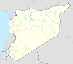
Położenie na mapie Syrii (c) Karte: NordNordWest, Lizenz: Creative Commons by-sa-3.0 de | |
| 36°12′52″N 36°46′11″E/36,214444 36,769722 | |
Ad-Dana (arab. الدانا) – miasto w Syrii, w muhafazie Idlib, w dystrykcie Harim, w poddystrykcie Ad-Dana. W 2004 roku liczyło 14 208 mieszkańców[1].
Przypisy
Media użyte na tej stronie
(c) Karte: NordNordWest, Lizenz: Creative Commons by-sa-3.0 de
Location map of Syria. De facto situation.
Łatwo można dodać ramkę naokoło tej grafiki
Autor: Internet Archive Book Images (Αρχικό) Wolfymoza (Ανέβασμα), Licencja: No restrictions
Ancient tomb of Dana
Identifier: cu31924095158964 Title: The universal geography : the earth and its inhabitants Year: 1876 (1870s) Authors: Reclus, Elisée, 1830-1905 Ravenstein, Ernest George, 1834-1913 Keane, A. H. (Augustus Henry), 1833-1912 Subjects: Geography Publisher: London : J.S. Virtue & Co., Ltd. Contributing Library: Cornell University Library Digitizing Sponsor: MSN
View Book Page: Book Viewer About This Book: Catalog Entry View All Images: All Images From Book
Click here to view book online to see this illustration in context in a browseable online version of this book.
Note About Images
Please note that these images are extracted from scanned page images that may have been digitally enhanced for readability - coloration and appearance of these illustrations may not perfectly resemble the original work.


