Aguascalientes (miasto)
 | |||
| |||
| Państwo | |||
|---|---|---|---|
| Stan | |||
| Stan | |||
| Gmina | Aguascalientes | ||
| Data założenia | 22 października 1575 | ||
| Burmistrz | Lorena Martínez Rodríguez, PRI (2011-) | ||
| Powierzchnia | 105,89 km² | ||
| Wysokość | 1 870 m n.p.m. | ||
| Populacja (2014) • liczba ludności |
| ||
| Nr kierunkowy | 449 | ||
| Kod pocztowy | 20000-20999 | ||
| Strona internetowa | |||
Aguascalientes – miasto w środkowym Meksyku, na przedgórzu Sierra Madre Zachodnia, stolica stanu Aguascalientes[1] oraz gminy o tej samej nazwie. Leży nad rzeką Río Aguascalientes. W 2014 roku miasto liczyło około 766,4 tysięcy mieszkańców. Wraz z miejscowościami Jesus María i San Francisco de los Romo tworzy obszar metropolitalny zamieszkały przez ponad milion mieszkańców[2].
Miasto jest głównym ośrodkiem gospodarczym stanu Aguascalientes. Okolica ma charakter rolniczy, uprawa oparta jest częściowo na sztucznym nawadnianiu. Uprawia się głównie zboża (przede wszystkim kukurydza), rośliny strączkowe, warzywa oraz drzewa owocowe. Ma miejsce również hodowla bydła. W mieście rozwinęło się rzemiosło oraz przemysł spożywczy[1]. Ponadto ma miejsce wydobycie rud ołowiu. Aguascalientes to ośrodek turystyczny, dzięki znajdującym się w mieście uzdrowiskom – gorące źródła, między innymi siarczane[1]. W 1973 roku został założony uniwersytet[1].
Demografia
Źródło: City Population
Miasta partnerskie
Zobacz też
Przypisy
- ↑ a b c d Aguascalientes, [w:] Encyklopedia PWN [online] [dostęp 2021-05-22].
- ↑ En estos días Aguascalientes llegará al millón de habitantes (hiszp.). [dostęp 2012-11-22].
Media użyte na tej stronie
The flag of Navassa Island is simply the United States flag. It does not have a "local" flag or "unofficial" flag; it is an uninhabited island. The version with a profile view was based on Flags of the World and as a fictional design has no status warranting a place on any Wiki. It was made up by a random person with no connection to the island, it has never flown on the island, and it has never received any sort of recognition or validation by any authority. The person quoted on that page has no authority to bestow a flag, "unofficial" or otherwise, on the island.
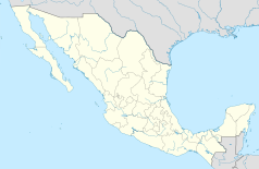
Location Map of Aguascalientes
Equirectangular projection, Geographic limits of the map:
- N: 22.50° N
- S: 21.60° N
- W: 102.90° W
- E: 101.70° W
Escudo del Estado Mexicano de Aguascalientes (México)
Autor: Vmzp85, Licencja: CC BY 3.0
Coats of Arms of the city of Aguascalientes, Aguscalientes (Mexico)
Coat of arms of Aguascalientes


