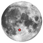
Albategnius (krater księżycowy)
 | |
| Ciało niebieskie | |
|---|---|
| Średnica krateru | 129 km |
| Głębokość krateru | 4,4 km |
| Źródło nazwy | |
Albategnius (łac. nazwisko muzułmańskiego uczonego al Battani z IX wieku) – krater uderzeniowy, położony pośrodku widocznej z Ziemi strony Księżyca. Jego ściany zewnętrzne przypominają kształt sześciokąta. Pierścień wokół krateru jest przerwany po stronie południowo-zachodniej przez mniejszy krater Klein.
Albategnius leży na południe od krateru Hipparchus, oraz na wschód od kraterów Ptolemeusz i Alphonsus. Powierzchnia w tym obszarze charakteryzuje się zbiorem blizn podobnych do formy kanałów biegnących z północy na południowy wschód.
Albategnius podobno miał zostać umieszczony na widocznym miejscu we wczesnym szkicu narysowanym przez Galileusza w jego książce Sidereus Nuncius wydanej w 1610 r.
Satelickie kratery
| Albategnius | Szerokość | Długość | Średnica |
|---|---|---|---|
| A | 8,9° S | 3,2° E | 7 km |
| B | 10,0° S | 4,0° E | 20 km |
| C | 10,3° S | 3,7° E | 6 km |
| D | 11,3° S | 7,1° E | 9 km |
| E | 12,9° S | 6,4° E | 14 km |
| G | 9,4° S | 1,9° E | 15 km |
| H | 9,7° S | 5,2° E | 11 km |
| J | 11,1° S | 6,2° E | 7 km |
| K | 9,9° S | 2,0° E | 10 km |
| L | 12,1° S | 6,3° E | 8 km |
| M | 8,9° S | 4,2° E | 9 km |
| N | 9,8° S | 4,5° E | 9 km |
| O | 13,2° S | 4,2° E | 5 km |
| P | 12,9° S | 4,5° E | 5 km |
| S | 13,3° S | 6,1° E | 6 km |
| T | 12,6° S | 6,1° E | 9 km |
Zobacz też
Linki zewnętrzne
Media użyte na tej stronie
Autor:
- Nuvola_apps_kmoon.png: David Vignoni / derivative work: Lady Whistler (talk)
Icon from Nuvola icon theme for KDE 3.x.
cylindrical map projection of the Moon. The Moon's whole surface was mapped by the Clementine spacecraft in 1994, here North is at the top. The dark floor of crater Plato is at the middle top above Mare Imbrium, while the bright floor and rays of crater Tycho is near the middle bottom below Mare Imbrium. Mare Procellarum is at the near left, and Mare Tranquillitatis is just right of centre and Mare Crisium is at the near right. The far left and far right show the contrast of the mostly cratered farside with small isolated mare.
Shiny LightSteelBlue button/marker widget. Used to mark the location of something such as a tourist attraction.
- Description: Location of the Albategnius crater on the en:Moon. The red mark also shows the proximity of the craters Klein, Parrot, Vogel, Argelander, Airy, Burnham, and Ritchey.
- Source: This is a modified version of the en:photo obtained from the NASA Planetary Photojournal. It was modified by RJHall.
- Width: 150 en:pixels
- Height: 150 pixels
Autor: James Stuby based on NASA image
, Licencja: CC0
Albategnius, on the moon. Splotch in lower left and streak in upper right are blemishes on original.


