Albert (Somma)
| miejscowość i gmina | |||
Neo-gotycka bazylika | |||
| |||
| Państwo | |||
|---|---|---|---|
| Region | |||
| Departament | |||
| Okręg | |||
| Kanton | Albert | ||
| Kod INSEE | 80016[1] | ||
| Powierzchnia | 13,81 km²[2] | ||
| Populacja (2011) • liczba ludności |
| ||
| • gęstość | 713 os./km² | ||
| Kod pocztowy | 80300 | ||
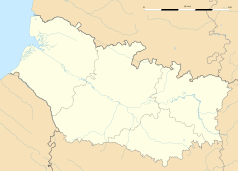
Położenie na mapie Sommy (c) Eric Gaba, Wikimedia Commons user Sting, CC BY-SA 3.0 | |||
| Strona internetowa | |||
| Portal | |||
Albert – miejscowość i gmina we Francji, w regionie Hauts-de-France, w departamencie Somma.
Według danych na rok 2011 gminę zamieszkiwało 9 837 osób, a gęstość zaludnienia wynosiła 713 osób/km²[3] (wśród 2293 gmin Pikardii Albert plasuje się na 21. miejscu pod względem liczby ludności, natomiast pod względem powierzchni na miejscu 240.).
Miasta partnerskie
 Ulverston (Cumbria) od 1976
 Niska (Saksonia) od 1964
 Aldenhoven (Nadrenia Północna-Westfalia) od 1981
Przypisy
- ↑ Kod INSEE na stronie francuskiego urzędu statystycznego (fr.)
- ↑ Statystyki na stronie francuskiego urzędu statystycznego (fr.)
- ↑ Populacja na stronie francuskiego urzędu statystycznego (fr.)
Media użyte na tej stronie
(c) Eric Gaba, Wikimedia Commons user Sting, CC BY-SA 3.0
Blank administrative map of the department of Somme, France, as in December 2014, for geo-location purpose, with distinct boundaries for regions, departments and arrondissements.
Autor: Superbenjamin, Licencja: CC BY-SA 4.0
Blank administrative map of France for geo-location purpose, with regions and departements distinguished. Approximate scale : 1:3,000,000
Autor: Flappiefh, Licencja: CC BY-SA 4.0
Carte administrative vierge de la région Hauts-de-France, France, destinée à la géolocalisation.
Flag of England. Saint George's cross (a red cross on a white background), used as the Flag of England, the Italian city of Genoa and various other places.
© Raimond Spekking / CC BY-SA 4.0 (via Wikimedia Commons)
Basilique Notre-Dame de Brebières, Albert, Somme


