Albi (Francja)
| miejscowość i gmina | |||
 Stary most i katedra św. Cecylii w Albi | |||
| |||
| Państwo | |||
|---|---|---|---|
| Region | |||
| Departament | |||
| Okręg | |||
| Kod INSEE | 81004 | ||
| Powierzchnia | 44,28 km² | ||
| Populacja (2018) • liczba ludności |
| ||
| • gęstość | 1145 os./km² | ||
| Kod pocztowy | 81990 | ||
| Strona internetowa | |||
| Portal | |||
| Obiekt z listy światowego dziedzictwa UNESCO | |
 | |
| Państwo | |
|---|---|
| Typ | kulturowy |
| Spełniane kryterium | IV, V |
| Numer ref. | |
| Region[b] | Europa i Ameryka Północna |
| Historia wpisania na listę | |
| Wpisanie na listę | |
Albi – miejscowość i gmina we Francji, na północny wschód od Tuluzy, w regionie Oksytania, w departamencie Tarn. Ośrodek administracyjny departamentu Tarn[1]. W 2018 roku jej populacja wynosiła 50 741 mieszkańców[2], gęstość zaludnienia wyniosła 1145.9 osób/km². Przez gminę przepływa rzeka Tarn[3]. W 2010 roku miasto wpisano na listę światowego dziedzictwa UNESCO[4].
Obecnie jest to ośrodek przemysłu maszynowego, porcelanowego, a także szklarskiego.
Miejsce urodzenia malarza i grafika Henri de Toulouse-Lautreca oraz pisarza Pierre Benoit. W renomowanym miejscowym liceum im. Lapérouse'a kształciło się wiele znanych osób, m.in. prezydent Georges Pompidou i aktor Pierre Mondy.
Historia
W średniowieczu miejscowość ta była centrum herezji katarów (albigensów).
Mieści się tu Katedra św. Cecylii, budowana w XIII-XIV wieku, będąca architektonicznym symbolem triumfu papiestwa nad heretykami.
Miasta partnerskie
Przypisy
- ↑ Atlas Routier France 2014. Michelin, s. 299. ISBN 978-2-06-719261-4. (fr.).
- ↑ Populations légales 2018 − Ces données sont disponibles sur toutes les communes de France hors Mayotte | Insee, www.insee.fr [dostęp 2021-03-29].
- ↑ Fiche cours d'eau – Le Tarn (O---0100). SANDRE. [dostęp 2017-07-26]. (fr.).
- ↑ World Heritage Committee inscribes five new cultural sites on World Heritage List and approves two extensions to existing properties. UNESCO.org. [dostęp 2010-08-02]. (ang.).
Linki zewnętrzne
- Oficjalna strona (fr.)
Media użyte na tej stronie
Autor: , Licencja: CC BY-SA 3.0
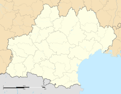
Blank administrative map of the department of Tarn, France, for geo-location purpose.
Autor: Superbenjamin, Licencja: CC BY-SA 4.0
Blank administrative map of France for geo-location purpose, with regions and departements distinguished. Approximate scale : 1:3,000,000
Autor: Flappiefh, Licencja: CC BY-SA 4.0
Carte administrative vierge de la région Languedoc-Roussillon-Midi-Pyrénées, France, destinée à la géolocalisation.
Autor: Pedro A. Gracia Fajardo, escudo de Manual de Imagen Institucional de la Administración General del Estado, Licencja: CC0
Flaga Hiszpanii
The flag of Navassa Island is simply the United States flag. It does not have a "local" flag or "unofficial" flag; it is an uninhabited island. The version with a profile view was based on Flags of the World and as a fictional design has no status warranting a place on any Wiki. It was made up by a random person with no connection to the island, it has never flown on the island, and it has never received any sort of recognition or validation by any authority. The person quoted on that page has no authority to bestow a flag, "unofficial" or otherwise, on the island.
Flag of the United Nations Educational, Scientific and Cultural Organization (UNESCO)
Autor: RainbowSilver2ndBackup, Licencja: CC BY-SA 4.0
Bandièra de la region administrativa francesa d'Occitània
Autor: Krzysztof Golik, Licencja: CC BY-SA 4.0
To obiekt wpisany na listę światowego dziedzictwa UNESCO, pod nazwą Cité épiscopale d'Albi.
Autor: Didier Descouens, Licencja: CC BY-SA 4.0
This building is indexed in the base Mérimée, a database of architectural heritage maintained by the French Ministry of Culture, under the reference PA00095483


