Aldershot
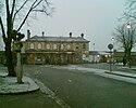
 Stacja kolejowa w Aldershot | |
| Państwo | |
|---|---|
| Kraj | |
| Hrabstwo | Hampshire |
| Populacja (2001) • liczba ludności | 58 170 |
| Nr kierunkowy | 01252 |
| Kod pocztowy | GU11 & GU12 |
Położenie na mapie Hampshire Contains Ordnance Survey data © Crown copyright and database right, CC BY-SA 3.0 | |
Położenie na mapie Wielkiej Brytanii (c) Karte: NordNordWest, Lizenz: Creative Commons by-sa-3.0 de | |
| Portal | |
Aldershot – miasto w Anglii w hrabstwie Hampshire, położone około 60 km na południowy zachód od Londynu. Ludność miasta wynosi 58 170 mieszkańców, natomiast aglomeracja Aldershot Urban Area, w skład której wchodzą m.in. Camberley, Farnborough oraz Farnham liczy 243 344 mieszkańców[1].
Miasto jest mocno związane z British Army, która w 1854 roku założyła w Aldershot garnizon i przyczyniła się do gwałtownego rozwoju niewielkiej wsi do wiktoriańskiego miasta. Aldershot znane jest jako Home of the British Army ("Dom Armii Brytyjskiej").
Przypisy
- ↑ Table KS01 Usual resident population. Office for National Statistics. [dostęp 2008-08-17]. [zarchiwizowane z tego adresu (2011-06-29)].
Media użyte na tej stronie
(c) Karte: NordNordWest, Lizenz: Creative Commons by-sa-3.0 de
Location map of the United Kingdom
Flag of England. Saint George's cross (a red cross on a white background), used as the Flag of England, the Italian city of Genoa and various other places.
Photographed by StairAl (sockpuppet of LewPot), 09.40 UTC, 25th January 2007. The full-size (and original) version of Aldershot railway station in the snow.jpg.
LewPot 21:08, 27 February 2007 (UTC)Contains Ordnance Survey data © Crown copyright and database right, CC BY-SA 3.0
Map of Hampshire, UK with the following information shown:
- Administrative borders
- Coastline, lakes and rivers
- Roads and railways
- Urban areas
Equirectangular map projection on WGS 84 datum, with N/S stretched 155%
Geographic limits:
- West: 2.01W
- East: 0.68W
- North: 51.41N
- South: 50.68N


