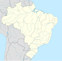
Alegre
| |||||
| |||||
| Państwo | |||||
| Stan | |||||
| Data założenia | 1890 | ||||
| Powierzchnia | 772,714[1] km² | ||||
| Wysokość | 277 m n.p.m. | ||||
| Populacja (2010) • liczba ludności • gęstość | 30 784[2] 39,84 os./km² | ||||
| Nr kierunkowy | 28 | ||||
| Kod pocztowy | 29500-000 a 29539-999 | ||||
| Strona internetowa | |||||
Alegre – miasto i gmina w Brazylii, w stanie Espírito Santo. Znajduje się w mezoregionie Sul Espírito-Santense i mikroregionie Alegre.
Przypisy
Media użyte na tej stronie
Autor:
- EspiritoSanto_MesoMicroMunicip.svg: Raphael Lorenzeto de Abreu
- derivative work: Milenioscuro (talk)
Location map of Espírito Santo state.
Equirectangular projection, N/S stretching 106 %. Geographic limits of the map:
- N: 17.75° S
- S: 21.41° S
- W: 42.02° W
- E: 39.5° W
This work is in the public domain in Brazil for one of the following reasons:
- It is a work published or commissioned by a Brazilian government (federal, state, or municipal) prior to 1983. (Law 3071/1916, art. 662; Law 5988/1973, art. 46; Law 9610/1998, art. 115)
- It is the text of a treaty, convention, law, decree, regulation, judicial decision, or other official enactment. (Law 9610/1998, art. 8)
- It is a work whose authors' rights belong to the Brazilian government (federal, state, or municipal), for which the economic rights shall be protected for a period of 70 years from the first of January of the year following that of their disclosure or that of the author's demise, whichever is later. ([2])
Flag of the State of Espírito Santo, Brazil.
(c) Viniciusramos16, CC-BY-SA-3.0
- Descrição:
- (Prefeitura de Alegre, ES)
- Fonte e créditos:
- (Fonte e créditos: Vinicius Ramos)
- Licença:
- (Licença: (Consulta Copyright e direitos autorais)
Bandeira do município de Alegre, estado do Espírito Santo, Brasil.


