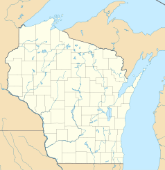
Algoma (Wisconsin)
| ||
 Centrum miasteczka | ||
| Państwo | ||
| Stan | ||
| Hrabstwo | Kewaunee | |
| Data założenia | 1834 | |
| Powierzchnia | 6,4 km² | |
| Wysokość | 178[1] m n.p.m. | |
| Populacja (2010) • liczba ludności • gęstość | 3 167[2] 530 os./km² | |
| Nr kierunkowy | 920 | |
| Kod pocztowy | 54201 | |
| Strefa czasowa | UTC-06:00 UTC-05:00 | |
| Strona internetowa | ||
| Portal | ||
Algoma – miasto w hrabstwie Kewaunee, stanie Wisconsin, USA. Według spisu z 2010 r. 3 167 mieszkańców, Należy do aglomeracji miejskiej miasta Green Bay. Położone jest nad jeziorem Michigan, u ujścia rzeki Ahnapee River.
Historia
Pierwsze zabudowania na terenie dzisiejszego miasta zostały założone w 1834 przez osadnika o nazwisku Joseph McCormick z Manitowoc. w 1851 roku osadnicy z Irlandii i Anglii zmienili nazwę osady na Wolf River, a w 1859 roku imigranci z Niemiec, Czech, Belgii i Skandynawii zmienili nazwę na Ahnapee[3].
23 lutego 1879 Ahnapee zostało zarejestrowane jako miasto, a jego nazwę zmieniono na Algoma[4]
W 1892 roku do miasta przybyła kolej, co przyczyniło się do rozwoju miejscowości.
Demografia
W 2010 roku w mieście Algoma mieszkało 3 167 mieszkańców tworzących 1 406 gospodarstwa domowe[2].
Przypisy
- ↑ GNIS Detail - Algoma
- ↑ a b American FactFinder - Results
- ↑ http://www.wisconsinhistory.org/dictionary/index.asp?action=view&term_id=6581
- ↑ Laws of Wisconsin of 1879, Rozdział 120
Media użyte na tej stronie
Autor: Uwe Dedering, Licencja: CC BY-SA 3.0
Location map of the USA (without Hawaii and Alaska).
EquiDistantConicProjection:
Central parallel:
* N: 37.0° N
Central meridian:
* E: 96.0° W
Standard parallels:
* 1: 32.0° N
* 2: 42.0° N
Made with Natural Earth. Free vector and raster map data @ naturalearthdata.com.
Formulas for x and y:
x = 50.0 + 124.03149777329222 * ((1.9694462586094064-({{{2}}}* pi / 180))
      * sin(0.6010514667026994 * ({{{3}}} + 96) * pi / 180))
y = 50.0 + 1.6155950752393982 * 124.03149777329222 * 0.02613325650382181
      - 1.6155950752393982  * 124.03149777329222 *
     (1.3236744353715044  - (1.9694462586094064-({{{2}}}* pi / 180))
      * cos(0.6010514667026994 * ({{{3}}} + 96) * pi / 180))
The flag of Navassa Island is simply the United States flag. It does not have a "local" flag or "unofficial" flag; it is an uninhabited island. The version with a profile view was based on Flags of the World and as a fictional design has no status warranting a place on any Wiki. It was made up by a random person with no connection to the island, it has never flown on the island, and it has never received any sort of recognition or validation by any authority. The person quoted on that page has no authority to bestow a flag, "unofficial" or otherwise, on the island.
Autor: Oryginalnym przesyłającym był Royalbroil z angielskiej Wikipedii, Licencja: CC BY-SA 2.5
A picture looking at part of en:Algoma, Wisconsin. The location looks over Lake Michigan, and includes the red w:Algoma Pierhead Lighthouse (right). This image was taken August 27, 2006 by User:Royalbroil
Autor: Royalbroil, Licencja: CC BY-SA 3.0
Looking south at downtown w:Algoma, Wisconsin on w:Wisconsin Highway 42.
Autor: Alexrk2, Licencja: CC BY 3.0
Ta mapa została stworzona za pomocą GeoTools.


