Alice Springs
 | |
| Państwo | |
|---|---|
| Terytorium | |
| Data założenia | 1872 |
| Powierzchnia | 148 km² |
| Populacja (2006[1]) • liczba ludności • gęstość |
|
| Kod pocztowy | 0870 – 0872 |
Położenie na mapie Australii  | |
Położenie na mapie Terytorium Północnego  | |
| Strona internetowa | |
| Portal | |
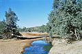
Alice Springs – miasto położone w Terytorium Północnym w Australii. Według spisu ludności z (2011), zamieszkuje je 25 186 osób[2] – jest to trzecie co do wielkości miasto Terytorium Północnego. W języku angielskim, szczególnie w Australii, nazywa się je często „the Alice”. Tereny, na których się znajduje są nazywane przez zamieszkujące je plemię aborygeńskie Ardente „Mparntwe”.
Alice Springs jest najbardziej znane z powieści Nevila Shute’a Miasteczko jak Alice Springs, w odległości 400 kilometrów od niego znajduje się także słynne Uluru.
W leżącym w pobliżu Pine Gap znajduje się ważna stacja radarowa i wczesnego ostrzegania obsługiwana przez armię amerykańską i australijską, w której pracuje ponad 700 osób.
Źródła od których pochodzi nazwa miasta
Stacja kolejowa w Alice Springs
Historia
Pierwotna nazwa miasta to Stuart, zostało założone jako przystanek dla podróżujących z północy na południe na grzbietach wielbłądów osadników. Zbudowano wtedy stację telegraficzną niedaleko źródła Alice, nazwanego tak na cześć żony sir Charlesa Todda, poczmistrza generalnego Australii Południowej, na cześć którego z kolei nazwano (zazwyczaj suchą) rzekę Todd River. W 1929 do miasta dotarła linia kolejowa (zwana dziś The Ghan) z Adelaide (w 2004 przedłużona do Darwin). W 1933 po długotrwałej debacie zmieniono nazwę miasta na Alice Springs, niemniej droga prowadząca z Adelajdy do Darwin i przechodząca przez Alice nadal nosi nazwę „autostrada Stuart”.
Geografia
Położone niemal dokładnie w środku kontynentu australijskiego.
Klimat
W mieście panuje klimat subtropikalny typu półpustynnego.
| Miesiąc | Sty | Lut | Mar | Kwi | Maj | Cze | Lip | Sie | Wrz | Paź | Lis | Gru | Roczna |
|---|---|---|---|---|---|---|---|---|---|---|---|---|---|
| Średnie temperatury w dzień [°C] | 36.9 | 35.6 | 32.9 | 28.6 | 23.5 | 19.8 | 20.0 | 23.1 | 28.1 | 31.4 | 34.0 | 35.6 | 29,1 |
| Średnie dobowe temperatury [°C] | 29.4 | 28.4 | 25.3 | 20.7 | 15.9 | 12.3 | 12.0 | 14.5 | 19.6 | 23.2 | 26.1 | 28.1 | 21,3 |
| Średnie temperatury w nocy [°C] | 21.8 | 21.1 | 17.7 | 12.7 | 8.2 | 4.7 | 3.9 | 5.9 | 11.0 | 14.9 | 18.1 | 20.5 | 13,4 |
| Opady [mm] | 39.9 | 40.3 | 35.4 | 20.3 | 18.2 | 13.6 | 16.5 | 5.1 | 7.1 | 21.3 | 32.7 | 40.9 | 291,2 |
| Średnia liczba dni z opadami | 4.6 | 4.3 | 3.5 | 2.5 | 2.8 | 2.6 | 2.3 | 1.8 | 2.3 | 4.2 | 5.6 | 6.4 | 42,9 |
| Średnie usłonecznienie (w godzinach) | 319 | 284 | 298 | 288 | 270 | 255 | 282 | 310 | 300 | 313 | 303 | 307 | 3509 |
| Źródło: Bureau of Meteorology[3] (liczba dni z opadami dla wartości 0,1 mm, wysokość 546 m n.p.m., 1981-2010) | |||||||||||||
Transport
W Alice Springs funkcjonuje regionalny port lotniczy Alice Springs. Ponadto działa tu stacja kolejowa Alice Springs. Miasto przecina linia kolejowa Adelaide–Darwin(ang.) / The Ghan oraz droga międzystanowa Stuart Highway.
Zobacz też
- Royal Flying Doctor Service of Australia
Przypisy
- ↑ 2006 Census QuickStats: Alice Springs (Urban Centre/Locality).
- ↑ 2011 Census QuickStats. Alice Springs. Australian Bureau of Statistics. [dostęp 2014-09-06].
- ↑ Bureau of Meteorology: Climate statistics for Australian locations. Alice Springs Airport.
Linki zewnętrzne
| Miasta | |
|---|---|
| Miejscowości | |
| Osady |
|
| Społeczności Aborygenów |
|
| Pozostałe |
|
![]()
Media użyte na tej stronie
Autor: , Licencja: CC BY-SA 3.0
Relief map of Australia, including the borders of the states of the Commonwealth of Australia

Autor: Tentotwo, Licencja: CC BY-SA 3.0
Relief location map of the Northern Territory, Australia Equidistant cylindrical projection, latitude of true scale 17.75° S (equivalent to equirectangular projection with N/S stretching 105 %). Geographic limits of the map:
- N: 10.6° S
- S: 26.5° S
- W: 127.5° E
- E: 139.5° E

Autor: Alexis O'Connor, Licencja: CC BY 2.0
I'm pretty sure trains like this are about half a mile long!


The flag of the Northern Territory (adopted on July 1, 1978 on the first day of self-government) was designed by the Australian artist Robert Ingpen, of Drysdale Victoria, after consultation with members of the community at the invitation of the Northern Territory Government. The flag incorporates the three official Territorian colours of black, white and ochre and is divided into two panels, black at the hoist side taking up one third the length of the flag while the remainder is equal to two third the length of the flag in ochre. The black panel display the five white stars that form the constellation of the Southern Cross, using the Victorian configuration of the Southern Cross with stars having between five to eight points. The flag also features the official Northern Territory floral emblem on the red ochre panel, a stylisation of the Sturt's Desert Rose, which uses seven petals encircling a seven-pointed black star of the federation in the centre. The seven petals symbolises the six Australian states plus the Northern Territory. The Northern Territory Flag was the first official flag that did not contain the Union Jack.
Autor: Johannes Püller, Licencja: CC BY-SA 2.0 at
Alice Springs, Australia