Alt Camp
(c) Joan M. Borràs (ebrenc), CC BY-SA 2.5 Położenie Alt Camp na mapie Katalonii | |||
| |||
| Państwo | |||
|---|---|---|---|
| Wspólnota autonomiczna | |||
| Comarca | Alt Camp | ||
| Powierzchnia | 538,01 km² | ||
| Populacja (2009) • liczba ludności • gęstość |
| ||
| 41°17′N 1°15′E/41,283333 1,250000 | |||
| Strona internetowa | |||
| Portal | |||
Alt Camp – comarca (powiat) w Hiszpanii, w Katalonii w prowincji Tarragona. Jej stolicą i największym miastem jest Valls. Ma 544,7 km² powierzchni i 35 635 mieszkańców.
Gminy
- Aiguamúrcia – 719
- Alcover – 4405
- Alió – 384
- Bràfim – 636
- Cabra del Camp – 859
- Figuerola del Camp – 319
- Els Garidells – 189
- La Masó – 285
- El Milà – 177
- Mont-ral – 180
- Montferri – 225
- Nulles – 369
- El Pla de Santa Maria – 1903
- El Pont d'Armentera – 596
- Puigpelat – 789
- Querol – 359
- La Riba – 679
- Rodonyà – 462
- El Rourell – 313
- Vallmoll – 1413
- Valls – 22851
- Vila-rodona – 1117
- Vilabella – 789
Linki zewnętrzne
Media użyte na tej stronie
Location map of Catalonia. Equirectangular projection, N/S stretching 130 %. Geographic limits of the map: * N: 42.99° N * S: 40.405° N * W: 0.55° O * E: 4.02° O
Autor: NordNordWest, Licencja: CC BY-SA 3.0
Location map of Spain
Equirectangular projection, N/S stretching 130 %. Geographic limits of the map:
- N: 44.4° N
- S: 34.7° N
- W: 9.9° W
- E: 4.8° E
Autor: Pedro A. Gracia Fajardo, escudo de Manual de Imagen Institucional de la Administración General del Estado, Licencja: CC0
Flaga Hiszpanii
The senyera, a flag of Catalonia, and also used by several lands and municipalities of the ancient Crown of Aragon
Autor: Lancastermerrin88, Licencja: CC BY-SA 4.0
Monastery of Santes Creus
Autor: Heralder, leek by Sodacan, Licencja: CC BY-SA 3.0
Coat of arms of the Alt Camp , Catalonia (Spain)
Proposed, not still officially adopted
Autor: Eric Sala & Tània García (uploaded to Commons by Baggio), Licencja: CC BY-SA 2.5
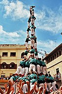
3 de 10 amb folre i manilles carregat pels Castellers de Vilafranca a la diada de Sant Fèlix del 2006.


