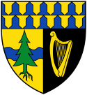
Altlengbach
| |||
 | |||
| |||
| Państwo | |||
| Kraj związkowy | |||
| Powiat | St. Pölten-Land | ||
| Powierzchnia | 35,54 km² | ||
| Wysokość | 302 m n.p.m. | ||
| Populacja (1 stycznia 2014) • liczba ludności | 2 762 | ||
| • gęstość | 78 os./km² | ||
| Numer kierunkowy | 02774 | ||
| Kod pocztowy | 3033 | ||
| Tablice rejestracyjne | PL | ||
| Strona internetowa | |||
Altlengbach – gmina targowa w Austrii, w kraju związkowym Dolna Austria, w powiecie St. Pölten-Land. Według Austriackiego Urzędu Statystycznego liczyła 2 762 mieszkańców (1 stycznia 2014)[1].
Przypisy
Media użyte na tej stronie
Autor: Rosso Robot, Licencja: CC BY-SA 3.0
Location map of Lower Austria
Equirectangular projection. Geographic limits of the map:
- N: 49.02796° N
- S: 47.38301° N
- W: 14.44565° E
- E: 17.07430° E
Autor: Lencer, Licencja: CC BY-SA 3.0
Location map of Austria
Equirectangular projection, N/S stretching 150 %. Geographic limits of the map:
- N: 49.2° N
- S: 46.3° N
- W: 9.4° E
- E: 17.2° E
Autor: Bwag, Licencja: CC BY-SA 3.0
Der Kirchturm mit dem Chor der röm.-kath. Pfarrkirche hll. Simon und Judas Thaddäus in der niederösterreichischen Marktgemeinde Altlengbach. Im Vordergrund der ehemalige Friedhof und ein Bildstock des hl. Nepomuk aus der Mitte des 18. Jahrhunderts.


