Ambérieu-en-Bugey
| miejscowość i gmina | |||
 Centrum i dworzec kolejowy (2008) | |||
| |||
| Państwo | |||
|---|---|---|---|
| Region | |||
| Departament | |||
| Okręg | |||
| Kanton | Ambérieu-en-Bugey | ||
| Kod INSEE | 01004 | ||
| Mer | Daniel Fabre (2014-2020) | ||
| Powierzchnia | 24,6 km² | ||
| Wysokość | 237-753 m n.p.m. | ||
| Populacja (2012 I) • liczba ludności |
| ||
| • gęstość | 601,5 os./km² | ||
| Kod pocztowy | 01500 | ||
| Strona internetowa | |||
| Portal | |||
Ambérieu-en-Bugey – miejscowość i gmina we Francji, w regionie Owernia-Rodan-Alpy, w departamencie Ain.
Demografia
Według danych ze stycznia 2012 r. gminę zamieszkiwało 14 796 osób, a gęstość zaludnienia wynosiła 601,5 osób/km².
Bibliografia
Linki zewnętrzne
- Oficjalna strona internetowa Ambérieu-en-Bugey. ville-amberieuenbugey.fr. [zarchiwizowane z tego adresu (2015-01-11)].
Media użyte na tej stronie
Autor: Superbenjamin, Licencja: CC BY-SA 4.0
Blank administrative map of France for geo-location purpose, with regions and departements distinguished. Approximate scale : 1:3,000,000
Autor: Flappiefh, Licencja: CC BY-SA 4.0
Carte administrative vierge de la région Auvergne-Rhône-Alpes, France, destinée à la géolocalisation.
Sight on Ambérieu railway station from the St-Denis-en-Bugey tower, in Ain, France.
Autor: Michiel1972, Licencja: CC BY-SA 3.0
Population - Municipality code 01004.svg
Population Census 1962-2008Autor: Flappiefh, Licencja: CC BY-SA 4.0
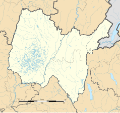
Blank administrative map of the department of Ain, France, for geo-location purpose.


