Ampflwang im Hausruckwald
 | |||
| |||
| Państwo | |||
|---|---|---|---|
| Kraj związkowy | |||
| Powiat | Vöcklabruck | ||
| Powierzchnia | 20,56 km² | ||
| Wysokość | 566 m n.p.m. | ||
| Populacja (1 stycznia 2015) • liczba ludności | 3412 | ||
| • gęstość | 166 os./km² | ||
| Numer kierunkowy | 07675 | ||
| Kod pocztowy | 4843 | ||
| Tablice rejestracyjne | VB | ||
| Strona internetowa | |||
Ampflwang im Hausruckwald – gmina targowa w Austrii, w kraju związkowym Górna Austria, w powiecie Vöcklabruck. 1 stycznia 2015 liczyła 3412 mieszkańców[1].
Przypisy
Media użyte na tej stronie
Autor: Rosso Robot, Licencja: CC BY-SA 3.0
Location map of Upper Austria
Equirectangular projection. Geographic limits of the map:
- N: 48.78063° N
- S: 47.44388° N
- W: 12.73041° E
- E: 15.00183° E
Autor: Lencer, Licencja: CC BY-SA 3.0
Location map of Austria
Equirectangular projection, N/S stretching 150 %. Geographic limits of the map:
- N: 49.2° N
- S: 46.3° N
- W: 9.4° E
- E: 17.2° E
Autor: Thomas Ledl, Licencja: CC BY-SA 4.0
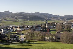
Ampflwang, Gesamtansicht. Links oben der Aussichtsturm Göblberg. Darunter die Remise des Lokparks. Rechts die Kirche, die Feuerwehr und das Reitzentrum. Im Hintergrund der Robinson Club.
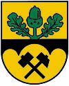
Herb Ampflwang im Hausruckwald, Górna Austria


