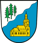
Amt Ruhland
| urząd | |||
| |||
| Państwo | |||
|---|---|---|---|
| Kraj związkowy | |||
| Powiat | |||
| Powierzchnia | 131,00 km² | ||
| Populacja • liczba ludności |
| ||
| Tablice rejestracyjne | OSL | ||
Adres urzędu: Rudolf Breitscheid Straße 4, 01945 Ruhland | |||
Położenie na mapie powiatu | |||
| 51°27′22,6″N 13°51′59,6″E/51,456278 13,866556 | |||
| Strona internetowa | |||
| Portal | |||
Urząd Ruhland (niem. Amt Ruhland, dolnołuż. Amt Rólany) – urząd w Niemczech, leżący w kraju związkowym Brandenburgia, w powiecie Oberspreewald-Lausitz. Siedziba urzędu znajduje się w mieście Ruhland[1].
W skład urzędu wchodzi sześć gmin:
- Grünewald (dolnołuż. Zeleny Hózd)
- Guteborn (górnołuż. Wudwor)
- Hermsdorf (górnołuż. Hermanecy)
- Hohenbocka (górnołuż. Hory Bukow)
- Ruhland (dolnołuż. Rólany)
- Schwarzbach (górnołuż. Čorna Woda)
Przypisy
- ↑ Statistisches Amt Berlin-Brandenburg, Potsdam, 2009
Media użyte na tej stronie
|
|
|
|
|
|
|
|


