An Bun Beag
| ||
Widok na wioskę, w tle góra Errigal | ||
| Państwo | ||
| Prowincja | Ulster | |
| Hrabstwo | Donegal | |
| Populacja (2011) • liczba ludności | 1553[1] | |
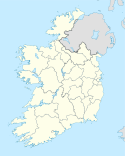
An Bun Beag (ang. Bunbeg) – wieś w hrabstwie Donegal w prowincji Ulster w Irlandii. W 2011 roku liczba mieszkańców wynosiła 1553 osób.
Przypisy
- ↑ Census 2011 Preliminary Report (ang.). [zarchiwizowane z tego adresu].
Media użyte na tej stronie
Bunbeg3333.jpg
(c) John Daye at the English Wikipedia, CC-BY-SA-3.0
A view of Bunbeg with Mount Errigal in the background and the wrecked Cara Na Mara (Friend of the Sea) on the tidal sandbanks of Magheraclogher beach. 'Bád Eddie' (Eddie's Boat) ran ashore due to rough seas in the early 1970s.
(c) John Daye at the English Wikipedia, CC-BY-SA-3.0
A view of Bunbeg with Mount Errigal in the background and the wrecked Cara Na Mara (Friend of the Sea) on the tidal sandbanks of Magheraclogher beach. 'Bád Eddie' (Eddie's Boat) ran ashore due to rough seas in the early 1970s.


