Anthisnes
 | |||||
| Państwo | |||||
|---|---|---|---|---|---|
| Region | |||||
| Prowincja | |||||
| Populacja • liczba ludności |
| ||||
| Nr kierunkowy | 04 | ||||
| Kod pocztowy | 4162 | ||||
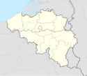
Położenie na mapie Belgii (c) Karte: NordNordWest, Lizenz: Creative Commons by-sa-3.0 de | |||||
| 50,481°N 5,522°E/50,481400 5,521700 | |||||
| Strona internetowa | |||||
Anthisnes – miejscowość i gmina w Belgii, w prowincji Liège. W 2018 roku liczyła 4204 mieszkańców.
Media użyte na tej stronie
Belgium adm location map.svg
(c) Karte: NordNordWest, Lizenz: Creative Commons by-sa-3.0 de
Location map of Belgium
(c) Karte: NordNordWest, Lizenz: Creative Commons by-sa-3.0 de
Location map of Belgium
Anthisnes JPG01.jpg
Autor: Jean-Pol GRANDMONT, Licencja: CC BY 2.0
Anthisnes (Belgium), the St. Lawrence abbey farm (XVIIth century).
Autor: Jean-Pol GRANDMONT, Licencja: CC BY 2.0
Anthisnes (Belgium), the St. Lawrence abbey farm (XVIIth century).
Anthisnes Belgium.svg
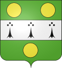
Flag of Anthisnes, in Liège province, Belgium. Description from FOTW: The municipal flag of Anthisnes is horizontally divided green-white-green, with two yellow disks placed horizontally in the upper green stripe, three black ermine spots placed horizontally in the white stripe, and one yellow disk placed in the lower green stripe, all these elements being placed close to the hoist.
Flag of Anthisnes, in Liège province, Belgium. Description from FOTW: The municipal flag of Anthisnes is horizontally divided green-white-green, with two yellow disks placed horizontally in the upper green stripe, three black ermine spots placed horizontally in the white stripe, and one yellow disk placed in the lower green stripe, all these elements being placed close to the hoist.


