Antoniadi (krater marsjański)
| ||
 | ||
| Ciało niebieskie | Mars | |
| Średnica krateru | 400,95 km | |
| Źródło nazwy | Eugène Michel Antoniadi | |
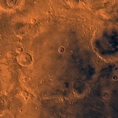
Antoniadi – duży krater położony na północnej półkuli Marsa, na obszarze Syrtis Major Planum. Nazwany na cześć greckiego astronoma Eugène'a Antoniadiego. Nazwa krateru została zatwierdzona przez Międzynarodową Unię Astronomiczną w 1973 roku[1].
Zobacz też
Przypisy
- ↑ Antoniadi (ang.). Gazetteer of Planetary Nomenclature. [dostęp 2013-03-02].
Linki zewnętrzne
Media użyte na tej stronie
Shiny LightSteelBlue button/marker widget. Used to mark the location of something such as a tourist attraction.
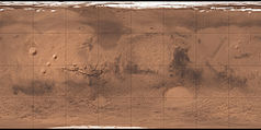
Carte de Mars reconstituée à partir des mesures de Mars Global Surveyor (MOLA) et des observations de Viking.
Mars digital-image mosaic merged with color of the MC-13 quadrangle, Syrtis Major region of Mars. The central part is dominated by dark dust and lava flows of the Syrtis Major Planitia region. These lava flows are partly bounded to the east by a large depression, Isidis basin, which contains smooth plains, and to the west and north by heavily cratered and moderately faulted highlands. Latitude range 0 to 30 degrees, longitude range -90 to -45 degrees.
Autor: F l a n k e r, Licencja: CC BY 3.0
symbol of Mars. 16 × 16 pixel nominal dimensions, lines 2 pixel thick, square caps. Colour 75% blue: red=0 green=0 blue=191 (#0000BF).


