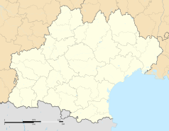
Antugnac
| miejscowość i gmina | |||
 Kościół Saint-André w Antugnac | |||
| |||
| Państwo | |||
|---|---|---|---|
| Region | |||
| Departament | |||
| Okręg | |||
| Kod INSEE | 11010 | ||
| Powierzchnia | 9,48 km² | ||
| Populacja (2013) • liczba ludności |
| ||
| Kod pocztowy | 11190 | ||
| Portal | |||
Antugnac – miejscowość i gmina we Francji, w regionie Oksytania, w departamencie Aude[1]. W 2013 roku jej populacja wynosiła 330 mieszkańców[2].
Zabytki
Zabytki w Antugnac posiadające status Monument historique[3]:
- Kościół Saint-André
Przypisy
- ↑ Atlas Routier France 2023. Michelin, s. 337. ISBN 978-2-06-725677-4. (fr.).
- ↑ Populations légales 2013. INSEE. [dostęp 2022-12-02]. (fr.).
- ↑ Monuments historiques de l'Aude. culture.gouv.fr. [dostęp 2014-10-02]. (fr.).
Media użyte na tej stronie
Autor: Superbenjamin, Licencja: CC BY-SA 4.0
Blank administrative map of France for geo-location purpose, with regions and departements distinguished. Approximate scale : 1:3,000,000
Autor: Flappiefh, Licencja: CC BY-SA 4.0
Carte administrative vierge de la région Languedoc-Roussillon-Midi-Pyrénées, France, destinée à la géolocalisation.
Autor: Flappiefh, Licencja: CC BY-SA 4.0
Blank administrative map of the department of Aude, France, for geo-location purpose.
Autor: Tournasol7, Licencja: CC BY-SA 4.0
This building is inscrit au titre des monuments historiques de la France. It is indexed in the base Mérimée, a database of architectural heritage maintained by the French Ministry of Culture, under the reference PA00102534


