Appat
| ||
 | ||
| Państwo | ||
| Terytorium zależne | ||
| Akwen | Morze Baffina | |
| Powierzchnia | 210,9 km² | |
| Długość linii brzegowej | 69 km | |
| Populacja • liczba ludności | 0 | |
| 76°33′N 69°45′W/76,550000 -69,750000 | ||
Appat (duń. Saunders Ø) – niezamieszkana wyspa u wschodnich wybrzeży Grenlandii położona na Morzu Baffina. Powierzchnia wyspy wynosi 210,9 km², a długość jej linii brzegowej to 69 km[1].
Przypisy
- ↑ Islands of Greenland (Denmark) (ang.). www.islands.unep.ch. [dostęp 2012-06-27].
Media użyte na tej stronie
Autor: Uwe Dedering, Licencja: CC BY-SA 3.0
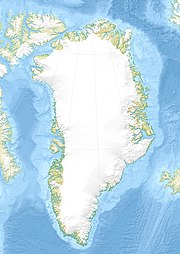
Relief location map of Greenland.
- Projection: EquiDistantConicProjection.
- Area of interest:
- N: 85.0° N
- S: 59.0° N
- W: -75.0° E
- E: -10.0° E
- Projection center:
- NS: 72.0° N
- WE: -42.5° E
- Standard parallels:
- 1: 64.0° N
- 2: 80.0° N
- GMT projection: -JD-42.5/72/64/80/20c
- GMT region: -R-60.16/57.61/24.5/79.91r
- GMT region for grdcut: -R-120.24/57.61/24.5/85.78r
- Relief: SRTM30plus.
- Made with Natural Earth. Free vector and raster map data @ naturalearthdata.com.
Saunders Island, a small island of north west Greenland; an aerial view of ice-capped Saunder’s Island ringed by a layer of thin sea ice in Baffin Bay.


