Ar-Rusafa (Hama)
| Państwo | |
|---|---|
| Muhafaza | |
| Populacja (2004) • liczba ludności |
|
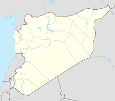
Położenie na mapie Syrii (c) Karte: NordNordWest, Lizenz: Creative Commons by-sa-3.0 de | |
Ar-Rusafa (arab. الرصافة) – miejscowość w Syrii, w muhafazie Hama. W 2004 roku liczyła 1608 mieszkańców[1].
Galeria
Przypisy
Media użyte na tej stronie
Syria location map3.svg
(c) Karte: NordNordWest, Lizenz: Creative Commons by-sa-3.0 de
Location map of Syria. De facto situation.
(c) Karte: NordNordWest, Lizenz: Creative Commons by-sa-3.0 de
Location map of Syria. De facto situation.
Flag of Syria.svg
Łatwo można dodać ramkę naokoło tej grafiki
Łatwo można dodać ramkę naokoło tej grafiki
Al-Rusafa, Syria 01.jpg
Autor: Folkertherlyn, Licencja: CC BY-SA 4.0
The fortress is located in the Masyaf Subdistrict in Masyaf District, located west of Hama and about 10 kilometers southwest of Masyaf.
Autor: Folkertherlyn, Licencja: CC BY-SA 4.0
The fortress is located in the Masyaf Subdistrict in Masyaf District, located west of Hama and about 10 kilometers southwest of Masyaf.
Al-Rusafa, Syria 02.jpg
Autor: Folkertherlyn, Licencja: CC BY-SA 4.0
The fortress is located in the Masyaf Subdistrict in Masyaf District, located west of Hama and about 10 kilometers southwest of Masyaf.
Autor: Folkertherlyn, Licencja: CC BY-SA 4.0
The fortress is located in the Masyaf Subdistrict in Masyaf District, located west of Hama and about 10 kilometers southwest of Masyaf.
Al-Rusafa, Syria 03.jpg
Autor: Folkertherlyn, Licencja: CC BY-SA 4.0
The fortress is located in the Masyaf Subdistrict in Masyaf District, located west of Hama and about 10 kilometers southwest of Masyaf.
Autor: Folkertherlyn, Licencja: CC BY-SA 4.0
The fortress is located in the Masyaf Subdistrict in Masyaf District, located west of Hama and about 10 kilometers southwest of Masyaf.
Fortress Al-Rusafa.jpg
Autor: Folkertherlyn, Licencja: CC BY-SA 4.0
Ruined fortress in the northwestern Syria
Autor: Folkertherlyn, Licencja: CC BY-SA 4.0
Ruined fortress in the northwestern Syria


