Archikatedra św. Andrzeja w Glasgow
| katedra | |||||||||||||
 Katedra Świętego Andrzeja w Glasgow | |||||||||||||
| Państwo | |||||||||||||
|---|---|---|---|---|---|---|---|---|---|---|---|---|---|
| Kraj | |||||||||||||
| Miejscowość | |||||||||||||
| Wyznanie | |||||||||||||
| Kościół | |||||||||||||
| Wezwanie | |||||||||||||
| |||||||||||||
| |||||||||||||
Położenie na mapie Glasgow Contains Ordnance Survey data © Crown copyright and database right, CC BY-SA 3.0 | |||||||||||||
Położenie na mapie Wielkiej Brytanii (c) Karte: NordNordWest, Lizenz: Creative Commons by-sa-3.0 de | |||||||||||||
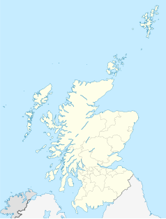
Położenie na mapie Szkocji | |||||||||||||
Archikatedra św. Andrzeja w Glasgow (ang. St. Andrew's Cathedral, Glasgow) – główna świątynia archidiecezji Glasgow kościoła rzymskokatolickiego. Mieści się na rogu ulic Clyde Street i Fox Lane.
Jest to neogotycka (Perpendicular Style) budowla wybudowana w latach 1814-1817, zaprojektowana przez architekta Jamesa Gillespie Grahama. Godność katedry posiada od 1889. Wybudowana na planie prostokąta na betonowym fundamencie. Mur ciosowy z kremowego piaskowca. Okna ze spiczastymi łukami i sztukateriami.
Zobacz też
Bibliografia
Media użyte na tej stronie
(c) Karte: NordNordWest, Lizenz: Creative Commons by-sa-3.0 de
Location map of the United Kingdom
Blue Shield - the Distinctive emblem for the Protection of Cultural Property. The distinctive emblem is a protective symbol used during armed conflicts. Its use is restricted under international law.
Autor: Michael Beckwith (changes by Rabanus Flavus), Licencja: CC BY 2.0
Glasgow, Roman Catholic Cathedral of Saint Andrew, Interior
Autor: Autor nie został podany w rozpoznawalny automatycznie sposób. Założono, że to Finlay McWalter (w oparciu o szablon praw autorskich)., Licencja: CC-BY-SA-3.0
St.Andrews R.C. Cathedral in Glasgow, Scotland
Taken by user:Finlay McWalter on the 3rd of September 2005Contains Ordnance Survey data © Crown copyright and database right, CC BY-SA 3.0
Blank map of Glasgow, UK with the following information shown:
- Administrative borders
- Coastline, lakes and rivers
- Roads and railways
- Urban areas
Equirectangular map projection on WGS 84 datum, with N/S stretched 175%
Geographic limits:
- West: 4.41W
- East: 4.05W
- North: 55.94N
- South: 55.73N
(c) Eric Gaba, NordNordWest, CC BY-SA 3.0
Location map of Scotland, United Kingdom


