Archipelag Baku
 Zdjęcie satelitarne Półwyspu Apszerońskiego z widocznymi wyspami | |
| Kontynent | |
|---|---|
| Państwo | |
| Akwen | |
Archipelag Baku – grupa wysp w pobliżu Baku (Azerbejdżan), na Morzu Kaspijskim. Wody wokół wyspy są płytkie.
Wyspy
- Böyük Zirə adası
- Daş Zirə adası
- Qum adası
- Səngi Muğan adası
- Zənbil adası
- Çigil adası
- Qarasu adası
- Xǝrǝ Zirǝ adası
- Gil adası
- Kür Daşı
Linki zewnętrzne
- Informacje ogólne. baku-guide.com. [zarchiwizowane z tego adresu (2016-10-18)].
Media użyte na tej stronie
Greater Baku, Azerbaijan, satellite image, LandSat-5, 2010-09-06, near natural colors, resolution 30 m
Autor: Uwe Dedering, Licencja: CC BY-SA 3.0
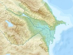
Location map of Azerbaijan.
Equirectangular projection. Strechted by 131.0%. Geographic limits of the map:
* N: 42.0° N
* S: 38.2° N
* W: 44.5° E
* E: 51.0° E
Made with Natural Earth. Free vector and raster map data @ naturalearthdata.com.


