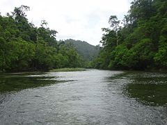
Mergui (archipelag)
 | |
| Kontynent | |
|---|---|
| Państwo | |
| Akwen | |
| 12°N 98°E/12,000000 98,000000 | |
Mergui (birm. မြိတ်ကျွန်းစု) – archipelag u wybrzeży Birmy, zamieszkiwany przez lud Moken[1].
Przypisy
- ↑ Sea Gypsies. W: Barbara A. West: Encyclopedia of the Peoples of Asia and Oceania. New York: Infobase Publishing, 2009, s. 717. ISBN 978-1-4381-1913-7. OCLC 370717954. (ang.).
Media użyte na tej stronie
Shiny LightSteelBlue button/marker widget. Used to mark the location of something such as a tourist attraction.
A river into Lampis Island
Autor: Uwe Dedering, Licencja: CC BY-SA 3.0
Location map of Myanmar.
Equirectangular projection. Strechted by 105.0%. Geographic limits of the map:
* N: 29.0° N
* S: 9.0° N
* W: 92.0° E
* E: 102.0° E
Made with Natural Earth. Free vector and raster map data @ naturalearthdata.com.


