Arco di Travertino
 | |
| Państwo | |
|---|---|
| Data otwarcia | 16 lutego 1980 |
| Poprzednia stacja | Colli Albani |
| Następna stacja | Porta Furba |
| Portal | |
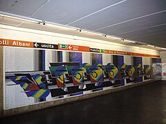
Arco di Travertino – stacja na linii A metra rzymskiego. Stacja została otwarta w 1980[1].
Przypisy
- ↑ UrbanRail.Net > Europe > Italy > Metropolitana di ROMA (Rome Metro), www.urbanrail.net [dostęp 2017-11-22].
Media użyte na tej stronie
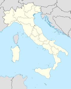
Location map Italy Rome.png
Autor: Dr. Blofeld, insert originally by Nordnordwest, Licencja: CC BY-SA 2.0
Map of Rome. Italy
Autor: Dr. Blofeld, insert originally by Nordnordwest, Licencja: CC BY-SA 2.0
Map of Rome. Italy
Geographic limits of the map:
- N: 41.993°
- S: 41.792°
- W: 12.308°
- E: 12.685°
Italy location map.svg
Autor: NordNordWest, Licencja: CC BY-SA 3.0
Location map of Italy (Commons photos) → en-Wikipedia Italy.
Autor: NordNordWest, Licencja: CC BY-SA 3.0
Location map of Italy (Commons photos) → en-Wikipedia Italy.
Italy Lazio location map.svg
Autor:
Location map of Lazio region (Italy)
Autor:
- Map_of_region_of_Lazio,_Italy.svg: User:Vonvikken
- derivative work: Milenioscuro (talk)
Location map of Lazio region (Italy)
Metropolitana di Roma A.svg
Icon of Rome underground line A.
Icon of Rome underground line A.
Metropolitana di Roma B.svg
Icon of Rome underground line B.
Icon of Rome underground line B.
Metropolitana di Roma B1.svg
Icon of Rome underground line B, branch B1.
Icon of Rome underground line B, branch B1.
Metro A - Arco di Travertino.jpg
Autor: Lalupa, Licencja: CC BY-SA 3.0
Roma - Metro A, stazione Arco di Travertino
Autor: Lalupa, Licencja: CC BY-SA 3.0
Roma - Metro A, stazione Arco di Travertino
Metropolitana di Roma C.svg
Icon of Rome underground line C.
Icon of Rome underground line C.
Logo Metropolitane Italia.svg
Logo delle metropolitane in Italia
Logo delle metropolitane in Italia


