Arlington (Teksas)
| ||||
 Arlington | ||||
| ||||
| Państwo | ||||
|---|---|---|---|---|
| Stan | ||||
| Hrabstwo | ||||
| Data założenia | 1843[1] | |||
| Prawa miejskie | 1920[1] | |||
| Kod statystyczny | ||||
| Burmistrz | Jim Ross | |||
| Powierzchnia | 257,5 km² | |||
| Wysokość | 184 m n.p.m. | |||
| Populacja (2020) • liczba ludności • gęstość |
| |||
| Nr kierunkowy | 682, 817 | |||
| Kod pocztowy | 76000-76099 | |||
| Strefa czasowa | ||||
| Strona internetowa | ||||
| Portal | ||||
Arlington – miasto w Stanach Zjednoczonych w stanie Teksas, w hrabstwie Tarrant, w konurbacji Dallas–Fort Worth. Według spisu z 2020 roku liczy 394,3 tys. mieszkańców[2].
Ośrodek naukowy, handlowy oraz przemysłowy w sektorze m.in. lotniczym, elektronicznym i samochodowym[1].
Położenie
Miasto położone jest pomiędzy Dallas, Grand Prairie i Fort Worth w południowej części Stanów Zjednoczonych, ok. 140 km na południe od granicy stanu Oklahoma.
Historia
Pierwszymi osadnikami w rejonie byli Indianie Kaddo, którzy w wyniku sporów z białymi osadnikam zostali zmuszeni do dalszej wędrówki[3]. W 1843 roku Republika Teksasu podpisała traktakt pokojowy z plemionami indiańskimi w Arlington[3].
Miasto zostało założone w 1876 roku i nazwane na cześć domu Roberta E. Lee[3].
Demografia
Etniczność
Pod względem etnicznym w 2019 roku w Arlington, dominowała ludność rasy białej (59,9%), następnie rasy czarnej (22,7%) w tym: Latynosi i Hiszpanie (38,6%), Azjaci (6,6%) oraz Indianie Ameryki Północnej (0,5%)[2].
Liczba ludności
Do wzrostu liczby ludności po 1950 roku, przyczynił się rozwój przemysłu w Arlington[3].
Zabytki i atrakcje turystyczne
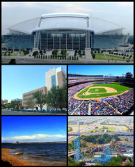
- Vandergriff Building (1927)
- Muzeum Sztuki (ang. Arlington Museum of Art) (1989)
- Teatr w Arlington
- Six Flags – park rozrywki
- Jezioro Arlington (przy granicy administracyjnej miasta)
Uczelnie
- University of Texas at Arlington (1895)
- Arlington Baptist College (1939)
Sport
| Dyscyplina | Nazwa/klub |
|---|---|
| Baseball | Texas Rangers |
| Koszykówka | Dallas Wings |
Miasta partnerskie
Współpraca międzynarodowa[4]:
 Niemcy: Bad Königshofen im Grabfeld (1951)
Przypisy
- ↑ a b c Arlington, [w:] Encyklopedia PWN [online] [dostęp 2021-01-19].
- ↑ a b U.S. Census Bureau QuickFacts: Arlington city, Texas, www.census.gov [dostęp 2022-01-03] (ang.).
- ↑ a b c d Arlington, [w:] Encyclopædia Britannica [online] [dostęp 2021-01-20] (ang.).
- ↑ LIS - Stadt Bad Königshofen i.Gr. - Partnerstädte, www.badkoenigshofen.rhoen-saale.net [dostęp 2021-01-20] (niem.).
Linki zewnętrzne
- Oficjalna strona miasta Arlington. ci.arlington.tx.us. [zarchiwizowane z tego adresu (1996-12-19)]. (ang.)
- Strona Teksańskiego Uniwersytetu w Arlington- University of Texas at Arlington (ang.)
Media użyte na tej stronie
Autor: Alexrk, Licencja: CC BY 3.0
Ta mapa została stworzona za pomocą GeoTools.
Autor: Uwe Dedering, Licencja: CC BY-SA 3.0
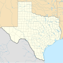
Location map of the USA (without Hawaii and Alaska).
EquiDistantConicProjection:
Central parallel:
* N: 37.0° N
Central meridian:
* E: 96.0° W
Standard parallels:
* 1: 32.0° N
* 2: 42.0° N
Made with Natural Earth. Free vector and raster map data @ naturalearthdata.com.
Formulas for x and y:
x = 50.0 + 124.03149777329222 * ((1.9694462586094064-({{{2}}}* pi / 180))
      * sin(0.6010514667026994 * ({{{3}}} + 96) * pi / 180))
y = 50.0 + 1.6155950752393982 * 124.03149777329222 * 0.02613325650382181
      - 1.6155950752393982  * 124.03149777329222 *
     (1.3236744353715044  - (1.9694462586094064-({{{2}}}* pi / 180))
      * cos(0.6010514667026994 * ({{{3}}} + 96) * pi / 180))
The flag of Navassa Island is simply the United States flag. It does not have a "local" flag or "unofficial" flag; it is an uninhabited island. The version with a profile view was based on Flags of the World and as a fictional design has no status warranting a place on any Wiki. It was made up by a random person with no connection to the island, it has never flown on the island, and it has never received any sort of recognition or validation by any authority. The person quoted on that page has no authority to bestow a flag, "unofficial" or otherwise, on the island.
A look over Lake Arlington.
Autor:
Loadmaster (David R. Tribble)

|
This image was made by Loadmaster (David R. Tribble)
Email the author: Also see my personal gallery at Google Photos |
The original Texas Giant roller coaster at Six Flags Over Texas in Arlington, Texas, prior to renovations in 2010.
(c) Michael Barera, CC BY-SA 4.0
The George W. Hawkes Downtown Library in Arlington, Texas (United States).
(c) Michael Barera, CC BY-SA 4.0
The Arlington Museum of Art in Arlington, Texas (United States).
Autor: Renelibrary, Licencja: CC BY-SA 4.0
Vandergriff Building in Arlington, Texas
Flag of Arlington, Texas.


