Arraial do Cabo
 | |||||
| Państwo | |||||
|---|---|---|---|---|---|
| Stan | |||||
| Data założenia | 1985 | ||||
| Burmistrz | Wanderson Cardoso de Brito | ||||
| Powierzchnia | 152,305 km² | ||||
| Wysokość | 8 m n.p.m. | ||||
| Populacja (2009) • liczba ludności • gęstość |
| ||||
| Nr kierunkowy | 22 | ||||
| Kod pocztowy | 28930-000 | ||||
| Strona internetowa | |||||
Arraial do Cabo – miasto w Brazylii, w stanie Rio de Janeiro. W 2009 liczyło 26 896 mieszkańców.
Media użyte na tej stronie
Autor:
- RiodeJaneiro_MesoMicroMunicip.svg: Raphael Lorenzeto de Abreu
- derivative work: Milenioscuro (talk)
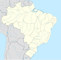
Location map of Rio de Janeiro state.
Equirectangular projection, N/S stretching 108 %. Geographic limits of the map:
- N: 20.69° S
- S: 23.43° S
- W: 44.96° W
- E: 40.82° W
View of the sea at Arraial do Cabo Municipallity
Autor: Domínio Público, Licencja: CC0
Brasão de armas do município de Arraial do Cabo, no estado do Rio de Janeiro. Esta obra pertence ao domínio público, já que foi publicada por um órgão governamental antes de 1983. (Lei nº 3071/1916, art. 662; Lei nº 5988/1973, art. 46; Lei nº 9610/1998, art. 115)
This work is in the public domain in Brazil for one of the following reasons:
- It is a work published or commissioned by a Brazilian government (federal, state, or municipal) prior to 1983. (Law 3071/1916, art. 662; Law 5988/1973, art. 46; Law 9610/1998, art. 115)
- It is the text of a treaty, convention, law, decree, regulation, judicial decision, or other official enactment. (Law 9610/1998, art. 8)
- It is a work whose authors' rights belong to the Brazilian government (federal, state, or municipal), for which the economic rights shall be protected for a period of 70 years from the first of January of the year following that of their disclosure or that of the author's demise, whichever is later. ([1])


