Arsia Mons
 | |
| Planeta | |
|---|---|
| Położenie | region Tharsis |
| Pasmo | |
| Wysokość | 16 000 m nad poziom odniesienia |
| Wybitność | 9000 m |
| Dane wulkanu | |
| Typ wulkanu | |
| Aktywność | |
Arsia Mons – najbardziej wysunięty na południe wulkan tarczowy formacji Tharsis Montes w regionie Tharsis na Marsie, jedyny położony na południe od równika.
Spłaszczony stożek tego wulkanu wznosi się ponad 9 km nad otaczającą wyżyną, zaś średnica jego kaldery to około 110 km.
Decyzją Międzynarodowej Unii Astronomicznej w 1973 roku nazwa tego obszaru pochodzi od Arsia Silva, cechy albedo nazwanej od lasu leżącego nieopodal Rzymu[1].
Przypisy
- ↑ MUA: Arsia Mons (ang.). [dostęp 2012-02-10].
Linki zewnętrzne

2. Tharsis Tholus
3. Ascraeus Mons
4. Pavonis Mons
5. Arsia Mons
6. Valles Marineris
Media użyte na tej stronie
Black up-pointing triangle ▲, U+25B2 from Unicode-Block Geometric Shapes (25A0–25FF)
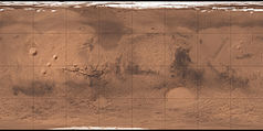
Carte de Mars reconstituée à partir des mesures de Mars Global Surveyor (MOLA) et des observations de Viking.
Title : Arsia Mons Spiral Cloud Description : One of the benefits of the Mars Global Surveyor (MGS) Mars Orbiter Camera(MOC) Extended Mission is the opportunity to observe how the planet's weather changes during a second full martian year. This picture of Arsia Mons was taken June 19, 2001; southern spring equinox occurred the same day. Arsia Mons is a volcano nearly large enough to cover the state of New Mexico. On this particular day (the first day of Spring), the MOC wide angle cameras documented an unusual spiral-shaped cloud within the 110 km(68 mi) diameter caldera--the summit crater--of the giant volcano. Because the cloud is bright both in the red and blue images acquired by the wide angle cameras, it probably consisted mostly of fine dust grains. The cloud's spin may have been induced by winds off the inner slopes of the volcano's caldera walls resulting from the temperature differences between the walls and the caldera floor, or by a vortex as winds blew up and over the caldera. Similar spiral clouds were seen inside the caldera for several days; we don't know if this was a single cloud that persisted throughout that time or one that regenerated each afternoon. Sunlight illuminates this scene from the left/upper left.


