Ashford (Kent)
 Dworzec kolejowy | |||
| |||
| Państwo | |||
|---|---|---|---|
| Kraj | |||
| Region | South East | ||
| Hrabstwo | Kent | ||
| Dystrykt | Ashford | ||
| Populacja (2001) • liczba ludności | 58 936 | ||
| Nr kierunkowy | 01233 | ||
| Kod pocztowy | TN23, TN24, TN25 | ||
Położenie na mapie Kentu Contains Ordnance Survey data © Crown copyright and database right, CC BY-SA 3.0 | |||
Położenie na mapie Wielkiej Brytanii (c) Karte: NordNordWest, Lizenz: Creative Commons by-sa-3.0 de | |||
| Portal | |||
Ashford – miasto w Anglii, w hrabstwie Kent, w dystrykcie Ashford, położone nad rzeką Great Stour.
W 2001 roku miasto liczyło 58 936 mieszkańców[1]. Ashford jest wspomniane w Domesday Book (1086) jako Allia Essetesford[2].
Przypisy
- ↑ KS01 Usual resident population: Census 2001, Key Statistics for urban areas (ang.). Office for National Statistics. [dostęp 2016-01-30]. [zarchiwizowane z tego adresu (2004-07-23)].
- ↑ The Domesday Book online
Media użyte na tej stronie
(c) Karte: NordNordWest, Lizenz: Creative Commons by-sa-3.0 de
Location map of the United Kingdom
Flag of England. Saint George's cross (a red cross on a white background), used as the Flag of England, the Italian city of Genoa and various other places.
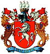
Coat of arms of Kent County Council, granted 17 october 1933. Text from[1]: "The arms were officially granted on 17 October 1933 and re-confirmed in 1975. The white horse of Kent is supposedly the old symbol for the Saxon kingdom of Kent, dating from the 6-8th century. The crest shows a mural crown, which symbolises the many castles in the county, as well as the independent Saxon kingdom of Kent. The sails are symbols for the strong ties of the county with the sea and stand for the navy, the mercantile marine and fisheries.The sea lions are also a symbol for the strong ties with the navy, the lion being the British lion. The sea lions also symbolise that Kent is the frontier of Britain with continental Europe. The left supporter wears the arms of the Cinque Ports, five harbour cities that had to provide support for the English navy until modern times. Four of these cities are in Kent. The arms are three lions with ship hulls as tails. The right supporter wears a shield with the arms of the Archbishopric of Canterbury, founded in 597 by St. Augustine. Canterbury is in Kent. The motto means 'unconquered'. In 1067, shortly after the Norman Conquest (1066, as every schoolboy knows), a detachment of Kentishmen ambushed the newly crowned King William and surrounded him. In return for his life, he promised that the county would be able to keep its ancient privileges - thus Kent was the only part of England unconquered by the Normans (that is, according to legend). "
Autor: Martin Belam z Hania, Crete, Licencja: CC BY-SA 2.0
(none)
Ashford Station
Contains Ordnance Survey data © Crown copyright and database right, CC BY-SA 3.0
Map of Kent, UK with the following information shown:
- Administrative borders
- Coastline, lakes and rivers
- Roads and railways
- Urban areas
Equirectangular map projection on WGS 84 datum, with N/S stretched 160%
Geographic limits:
- West: 0.01E
- East: 1.47E
- North: 51.52N
- South: 50.88N


