Aurora (Kolorado)
| ||||
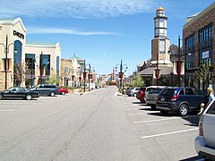
(c) Mountain Mike Johans…, CC BY 3.0 | ||||
| Przydomek: The Gateway to the Rockies, The Sunrise of Colorado | ||||
| Państwo | ||||
|---|---|---|---|---|
| Stan | ||||
| Hrabstwo | ||||
| Data założenia | 1891[1] | |||
| Prawa miejskie | 1903[1] | |||
| Kod statystyczny | GNIS ID: 0204737 | |||
| Burmistrz | ||||
| Powierzchnia | 416,2 km² | |||
| Wysokość | 1648 m n.p.m. | |||
| Populacja (2020) • liczba ludności • gęstość |
| |||
| Nr kierunkowy | 303, 720 | |||
| Kod pocztowy | 80010-80019, 80040-80047, 80247 | |||
| Strefa czasowa | ||||
| Strona internetowa | ||||
| Portal | ||||
Aurora – miasto w Stanach Zjednoczonych, w stanie Kolorado. Według spisu z 2020 roku liczy 386,3 tys. mieszkańców i jest trzecim co do wielkości miastem stanu Kolorado[2]. Jest częścią obszaru metropolitalnego Denver, a większa część miasta znajduje się w hrabstwie Arapahoe.
W mieście rozwinął się przemysł lotniczy, maszynowy oraz elektroniczny[1]. Ośrodek turystyczny[1].
W Aurorze znajduje się Kampus Medyczny Anschutzów, część Uniwersytetu Kolorado, oraz Baza Sił Kosmicznych Buckley.
Miasta partnerskie
W latach 1992–2016 Aurora współpracowała z Zieloną Górą[3].
Ludzie urodzeni w Aurorze
Zobacz też
Przypisy
- ↑ a b c d Aurora, [w:] Encyklopedia PWN [online] [dostęp 2021-10-19].
- ↑ U.S. Census Bureau QuickFacts: Aurora city, Colorado; United States, www.census.gov [dostęp 2022-02-01] (ang.).
- ↑ Our Sister Cities, [w:] aurorasistercities.org [online] [dostęp 2022-02-01] (ang.).
Media użyte na tej stronie
Autor: NordNordWest, Licencja: CC BY 3.0
Location map of Colorado, USA
Autor: Uwe Dedering, Licencja: CC BY-SA 3.0
Location map of the USA (without Hawaii and Alaska).
EquiDistantConicProjection:
Central parallel:
* N: 37.0° N
Central meridian:
* E: 96.0° W
Standard parallels:
* 1: 32.0° N
* 2: 42.0° N
Made with Natural Earth. Free vector and raster map data @ naturalearthdata.com.
Formulas for x and y:
x = 50.0 + 124.03149777329222 * ((1.9694462586094064-({{{2}}}* pi / 180))
      * sin(0.6010514667026994 * ({{{3}}} + 96) * pi / 180))
y = 50.0 + 1.6155950752393982 * 124.03149777329222 * 0.02613325650382181
      - 1.6155950752393982  * 124.03149777329222 *
     (1.3236744353715044  - (1.9694462586094064-({{{2}}}* pi / 180))
      * cos(0.6010514667026994 * ({{{3}}} + 96) * pi / 180))
The flag of Navassa Island is simply the United States flag. It does not have a "local" flag or "unofficial" flag; it is an uninhabited island. The version with a profile view was based on Flags of the World and as a fictional design has no status warranting a place on any Wiki. It was made up by a random person with no connection to the island, it has never flown on the island, and it has never received any sort of recognition or validation by any authority. The person quoted on that page has no authority to bestow a flag, "unofficial" or otherwise, on the island.
Flag of Ethiopia


