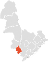
Aust-Agder
| okręg | |||||
 | |||||
| Państwo | |||||
|---|---|---|---|---|---|
| Region | |||||
| Siedziba | |||||
| Kod ISO 3166-2 | NO-09 | ||||
| Powierzchnia | 9157 km² | ||||
| Populacja (2019) • liczba ludności |
| ||||
| • gęstość | 12,85 os./km² | ||||
Położenie na mapie Norwegii | |||||
| Portal | |||||
Aust-Agder („wschodni Agder”) – dawny okręg, jednostka podziału administracyjnego Norwegii. Przestał istnieć 1 stycznia 2020, gdy na podstawie reformy z 2017 został włączony, wraz z okręgiem Vest-Agder, do nowo utworzonego okręgu Agder[1].
Położony był na południu kraju; graniczył z norweskimi okręgami Rogaland, Telemark oraz Vest-Agder. Zajmował powierzchnię 9157 km², która zamieszkiwana była przez 117 655 osób (2019). Ośrodkiem administracyjnym okręgu było miasto Arendal[2].
Gminy
Okręg podzielony był na 15 gmin[2].
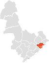
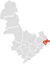
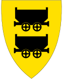
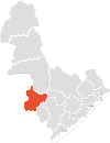
| Lp. | Położenie | Herb | Gmina | Powierzchnia [km²] | Populacja (2018 ) | Gęstość [osób/km²] |
|---|---|---|---|---|---|---|
| 1. | Åmli | 1130,6 | 1856 | 1,64 | ||
| 2. | Arendal | 270,1 | 44 576 | 165,04 | ||
| 3. | Birkenes | 674,2 | 5178 | 7,68 | ||
| 4. | Bygland | 1113,7 | 1200 | 1,08 | ||
| 5. | Bykle | 1467,1 | 952 | 0,65 | ||
| 6. | Evje og Hornnes | 550,2 | 3614 | 6,57 | ||
| 7. | Froland | 644,6 | 5713 | 8,86 | ||
| 8. | Gjerstad | 322,1 | 2511 | 7,8 | ||
| 9. | Grimstad | 303,6 | 22 692 | 74,74 | ||
| 10. | Iveland | 261,6 | 1342 | 5,13 | ||
| 11. | Lillesand | 190,4 | 10 702 | 56,21 | ||
| 12. | Risør | 193,0 | 6936 | 35,94 | ||
| 13. | Tvedestrand | 217,6 | 6051 | 27,81 | ||
| 14. | Valle | 1265,3 | 1246 | 0,98 | ||
| 15. | Vegårshei | 355,7 | 2104 | 5,92 | ||
| Aust-Agder | 9157,8 | 116 673 | 12,74 | |||
Przypisy
- ↑ Ole T. Berg i inni, Fylke, [w:] Store Norske leksikon [online] [dostęp 2022-03-20] (norw. bokmål).
- ↑ a b Geir Thorsnæs, Aust-Agder (tidligere fylke), [w:] Store Norske leksikon [online] [dostęp 2022-03-20] (norw. bokmål).
Media użyte na tej stronie
Map of Åmli, Aust-Agder, Norway
Flag of Aust-Agder
Map of Gjerstad in Aust-Agder, Norway
Map of Tvedestrand in Aust-Agder, Norway
Kommunevåpen for Risør kommune i Aust-Agder fylke.
Map of Vegårshei in Aust-Agder, Norway
Map of Risør in Aust-Agder, Norway
Autor: Krg, Licencja: CC BY-SA 4.0
Typical landscape in county Aust-Agder in Norway. Litjørn eller Litjern ved gården Li.
Kommunevåpen for Froland kommune i Aust-Agder fylke.
Coat of arms for Aust-Agder county (fylke), Norway
Kommunevåpen for Arendal kommune i Aust-Agder fylke.
Kommunevåpen for Grimstad kommune i Aust-Agder fylke.
Autor: TUBS
Location of county/ region xy (see filename) in Norway.
Map of Valle, Aust-Agder, Norway
Kommunevåpen for Lillesand kommune i Aust-Agder fylke.
Kommunevåpen for Iveland kommune i Aust-Agder fylke.
Kommunevåpen for Bykle kommune i Aust-Agder fylke.
Kommunevåpen for Birkenes kommune i Aust-Agder fylke.
Map of Froland, Aust-Agder, Norway
Kommunevåpen for Bygland kommune i Aust-Agder fylke.
Map of Lillesand in Aust-Agder, Norway
Kommunevåpen for Gjerstad kommune i Aust-Agder fylke.
Map of Arendal in Aust-Agder, Norway
Map of Evje and Hornes, Aust-Agder, Norway
Map of Iveland in Aust-Agder, Norway
