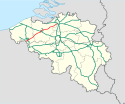
Autostrada A14 (Belgia)
| Długość | 101 km | |||||||||||||||||||||||||||||||||||||||||||||||||||||||||||||||||||||||||||||||||||||||||||||||||||||||||||||||||||||||||||||||||||||||||||||||||||||||||||||||||||||||||||||||||||
| Prowincje | Flandria Zachodnia, Flandria Wschodnia, Antwerpia | |||||||||||||||||||||||||||||||||||||||||||||||||||||||||||||||||||||||||||||||||||||||||||||||||||||||||||||||||||||||||||||||||||||||||||||||||||||||||||||||||||||||||||||||||||
| Mapa | ||||||||||||||||||||||||||||||||||||||||||||||||||||||||||||||||||||||||||||||||||||||||||||||||||||||||||||||||||||||||||||||||||||||||||||||||||||||||||||||||||||||||||||||||||||
 | ||||||||||||||||||||||||||||||||||||||||||||||||||||||||||||||||||||||||||||||||||||||||||||||||||||||||||||||||||||||||||||||||||||||||||||||||||||||||||||||||||||||||||||||||||||
| Zdjęcie | ||||||||||||||||||||||||||||||||||||||||||||||||||||||||||||||||||||||||||||||||||||||||||||||||||||||||||||||||||||||||||||||||||||||||||||||||||||||||||||||||||||||||||||||||||||
 | ||||||||||||||||||||||||||||||||||||||||||||||||||||||||||||||||||||||||||||||||||||||||||||||||||||||||||||||||||||||||||||||||||||||||||||||||||||||||||||||||||||||||||||||||||||
Autostrada A14 (E17) – autostrada w Belgii o długości 101 km, od 1985 stanowiąca część europejskiej trasy E17 (i tak jest formalnie oznakowana), łącząca Antwerpię, Gandawę, z granicą belgijsko-francuską (tam przechodząca we francuską A22, prowadzącą na przedmieścia Lille).
Wybudowana w latach 1967–1972. Jej pierwszy odcinek oddano do użytkowania 31 maja 1969 (Kruibeke − Anvers Ouest/R1), a ostatni (granica z Francją − parking Rekkem) – 4 listopada 1972.
Na poszczególnych odcinkach autostrada A14 posiada różne przekroje poprzeczne. Na przeważającej długości jest drogą dwujezdniową, o przekrojach jezdni: od 2 × 2 pasy ruchu, przez 2 × 3 pasy ruchu, po 2 × 4 pasy ruchu. Natomiast dwa jej odcinki posiadają cztery jezdnie o przekrojach: 2+2+2+3 (Gent-Centrum − Zwijnaarde) i 2+3+3+2 (Sint-Niklaas-Centrum – Sint-Niklaas-West).
Do 1985 stanowiła część dawnej europejskiej trasy E3 (i tak była formalnie oznakowana), a od jej oznaczenia wziął nazwę jednodniowy wyścig kolarski – E3 Harelbeke.
| ||||||||||||||
Media użyte na tej stronie
Tabliczka belgijskiej autostrady
Sign no. 392 - Customs, darker version
prom rzeka-icon.
(Motorway) tunnel Icon. Drawing similar to Swiss road signs.
Gas station symbol
AIGA Air Transportation sign (inverted)
Parking icon. Drawing similar to Polish road signs.
Tabliczka belgijskiej autostrady
French motorway A22
Tabliczka belgijskiej autostrady
Autor: nl:User:LimoWreck, Licencja: CC BY 2.5
Beginning of B401 link road. B401 splits of from A14/E17 at interchange Gent-Centrum. The main axis of the E17 is just visible on the left (the road with the white van). Central in the picture is the en:Collector/distributor road used for the exit Gent-UZ, the junction with the B401 and access to the B401 and E17. The bridge in the distance at the left is the B401 entering Gent. (The church of Ledeberg can be seen). Image taken from the bridge with the Corneel Heymanslaan.


